Flying W Airport
Coordinates: 39°56′03.4″N 074°48′26.1″W / 39.934278°N 74.807250°W
| Flying W Airport | |||||||||||
|---|---|---|---|---|---|---|---|---|---|---|---|
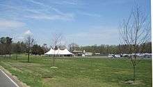 Front of the restaurant / motel complex at the airport | |||||||||||
| Summary | |||||||||||
| Airport type | Public use | ||||||||||
| Owner | Cave Holdings - Flying W, LLC | ||||||||||
| Operator | Mindy Redner | ||||||||||
| Serves | Lumberton and Medford townships | ||||||||||
| Location | Burlington County, New Jersey | ||||||||||
| Opened | 1964 | ||||||||||
| Elevation AMSL | 49 ft / 15 m | ||||||||||
| Runways | |||||||||||
| |||||||||||
| Statistics (2009) | |||||||||||
| |||||||||||
Flying W Airport (FAA LID: N14) is a public-use airport located one nautical mile (1.852 km) southwest of the central business district of Lumberton Township in Burlington County, New Jersey, United States. The airport is privately owned.[1] The address is 60 Fostertown Road, Medford, NJ 08055.
Facilities and aircraft
Flying W Airport covers an area of 170 acres (69 ha) at an elevation of 49 feet (15 m) above mean sea level. It has one runway designated 01/19 with an asphalt surface measuring 3,496 by 75 feet (1066 x 22 m).[1] The property was bought in 1961 by local pilot, William Whitesell. He converted the former farmland to its current use in 1964, naming it "Flying 'W'" for his last name. After Whitesell declared bankruptcy in 1972, the airport closed until 1984 when it reopened.[2]
For the 12-month period ending February 19, 2009, the airport had 74,222 aircraft operations, an average of 203 per day: 100% general aviation. At that time there were 119 aircraft based at this airport: 85% single-engine, 8% helicopters and 7% multi-engine.[1]
In addition to the airport facilities, there is a restaurant and a 28-room motel on-site. In 2016, the portion of the airport within Medford Township was proposed to be converted to a 450-unit housing complex by 2025. The deal would not affect the restaurant and motel complex within Lumberton Township.[2]
Incidents and Accidents
On September 8, 2017, a Schweizer 300 helicopter crashed near the end of a runway, killing passenger Troy Gentry.[3]
References
- 1 2 3 4 FAA Airport Master Record for N14 (Form 5010 PDF), effective 2012-02-09
- 1 2 Levinsky, Dave (November 26, 2016). "Flying W Airport in Medford targeted for 450-home development". Burlington County Times. Retrieved April 18, 2017. (Subscription required (help)).
- ↑ https://www.nytimes.com/2017/09/08/arts/music/troy-gentry-dead-country-montgomery-gentry.html
External links
- Resources for this airport:
- FAA airport information for N14
- AirNav airport information for N14
- FlightAware airport information and live flight tracker
- SkyVector aeronautical chart for N14