Flora, Apayao
| Flora | ||
|---|---|---|
| Municipality | ||
| Municipality of Flora | ||
| ||
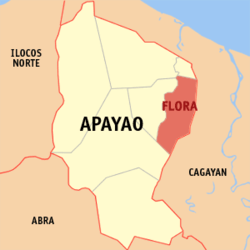 Map of Apayao with Flora highlighted | ||
.svg.png) Flora Location within the Philippines | ||
| Coordinates: 18°07′N 121°24′E / 18.12°N 121.4°ECoordinates: 18°07′N 121°24′E / 18.12°N 121.4°E | ||
| Country |
| |
| Region | Cordillera Administrative Region (CAR) | |
| Province | Apayao | |
| District | Lone District | |
| Barangays | 16 (see Barangays) | |
| Government [1] | ||
| • Type | Sangguniang Bayan | |
| • Mayor | Richard U. De San Jose | |
| • Electorate | 9,490 voters (2016) | |
| Area [2] | ||
| • Total | 324.40 km2 (125.25 sq mi) | |
| Population (2015 census)[3] | ||
| • Total | 17,391 | |
| • Density | 54/km2 (140/sq mi) | |
| Time zone | UTC+8 (PST) | |
| ZIP code | 3810 | |
| PSGC | 148103000 | |
| IDD : area code | +63 (0)74 | |
| Climate type | Tropical rainforest climate | |
| Income class | 3rd municipal income class | |
| Revenue (₱) | 95,064,080.94 (2016) | |
| Native languages |
Isnag Tagalog | |

Flora, officially the Municipality of Flora, is a 3rd class municipality in the province of Apayao, Philippines. According to the 2015 census, it has a population of 17,391 people.[3]
Flora was created into a municipality on June 22, 1963 when several barrios and sitios of Pudtol were constituted into the newly created town.[4]
Geography
Flora is located at 18°07′N 121°24′E / 18.12°N 121.4°E.
According to the Philippine Statistics Authority, the municipality has a land area of 324.40 square kilometres (125.25 sq mi) [2] constituting 7.35% of the 4,413.35-square-kilometre- (1,704.00 sq mi) total area of Apayao.
Barangays
Flora is politically subdivided into 16 barangays.[5]
| PSGC | Barangay | Population | ±% p.a. | |||
|---|---|---|---|---|---|---|
| 2015[3] | 2010[6] | |||||
| 148103001 | Allig | 9.4% | 1,635 | 1,507 | 1.56% | |
| 148103002 | Anninipan | 6.0% | 1,047 | 930 | 2.28% | |
| 148103003 | Atok | 3.7% | 642 | 584 | 1.82% | |
| 148103004 | Bagutong | 7.8% | 1,365 | 1,384 | −0.26% | |
| 148103005 | Balasi | 1.4% | 243 | 238 | 0.40% | |
| 148103006 | Balluyan | 8.2% | 1,429 | 1,501 | −0.93% | |
| 148103008 | Malayugan | 7.4% | 1,294 | 1,290 | 0.06% | |
| 148103012 | Mallig | 3.2% | 564 | 538 | 0.90% | |
| 148103009 | Malubibit Norte | 5.8% | 1,008 | 1,005 | 0.06% | |
| 148103013 | Malubibit Sur | 3.4% | 588 | 459 | 4.83% | |
| 148103010 | Poblacion East | 15.6% | 2,717 | 2,598 | 0.86% | |
| 148103014 | Poblacion West | 11.4% | 1,990 | 2,120 | −1.20% | |
| 148103015 | San Jose | 4.1% | 714 | 690 | 0.65% | |
| 148103016 | Santa Maria | 5.7% | 998 | 817 | 3.88% | |
| 148103011 | Tamalunog | 5.3% | 921 | 837 | 1.84% | |
| 148103017 | Upper Atok (Coliman) | 1.4% | 236 | 245 | −0.71% | |
| Total | 17,391 | 16,743 | 0.73% | |||
Demographics
| Population census of Flora | ||
|---|---|---|
| Year | Pop. | ±% p.a. |
| 1970 | 6,510 | — |
| 1975 | 9,380 | +7.60% |
| 1980 | 12,295 | +5.56% |
| 1990 | 10,810 | −1.28% |
| 1995 | 12,310 | +2.46% |
| 2000 | 14,860 | +4.12% |
| 2007 | 16,016 | +1.04% |
| 2010 | 16,743 | +1.63% |
| 2015 | 17,391 | +0.73% |
| Source: Philippine Statistics Authority[3] [6] [7] [8] | ||
In the 2015 census, Flora had a population of 17,391.[3] The population density was 54 inhabitants per square kilometre (140/sq mi).
Religion
The dominant religion in the city is Roman Catholic (Saint Joseph Parish in Poblacion East. However, other Christian sectors are also present in Flora such as Iglesia ni Cristo, United Methodist Church.
References
- ↑ "Municipality". Quezon City, Philippines: Department of the Interior and Local Government. Retrieved 31 May 2013.
- 1 2 "Province: Apayao". PSGC Interactive. Quezon City, Philippines: Philippine Statistics Authority. Retrieved 12 November 2016.
- 1 2 3 4 5 Census of Population (2015). "Cordillera Administrative Region (CAR)". Total Population by Province, City, Municipality and Barangay. PSA. Retrieved 20 June 2016.
- ↑ "Republic Act No. 3672 - An Act Creating the Municipality of Flora in the Subprovince of Apayao, Mountain Province". Chan Robles Virtual Law Library. 22 June 1963. Archived from the original on 26 September 2016. Retrieved 4 November 2016.
- ↑ "Municipal: Flora, Apayao". PSGC Interactive. Quezon City, Philippines: Philippine Statistics Authority. Retrieved 8 January 2016.
- 1 2 Census of Population and Housing (2010). "Cordillera Administrative Region (CAR)". Total Population by Province, City, Municipality and Barangay. NSO. Retrieved 29 June 2016.
- ↑ Censuses of Population (1903–2007). "Cordillera Administrative Region (CAR)". Table 1. Population Enumerated in Various Censuses by Province/Highly Urbanized City: 1903 to 2007. NSO.
- ↑ "Province of Apayao". Municipality Population Data. Local Water Utilities Administration Research Division. Retrieved 17 December 2016.
External links
| Wikimedia Commons has media related to Flora, Apayao. |
Places adjacent to Flora, Apayao | |
|---|---|
Kabugao (capital) | |
| Municipalities | |
| Barangays | |