Flemington, Pennsylvania
| Flemington, Pennsylvania | |
|---|---|
| Borough | |
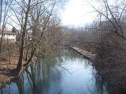 Remnant of the Bald Eagle Crosscut Canal in Flemington | |
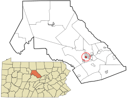 Location in Clinton County and the U.S. state of Pennsylvania. | |
| Coordinates: 41°07′35″N 77°28′17″W / 41.12639°N 77.47139°WCoordinates: 41°07′35″N 77°28′17″W / 41.12639°N 77.47139°W | |
| Country | United States |
| State | Pennsylvania |
| County | Clinton |
| Settled | 1838 |
| Incorporated (borough) | 1864 |
| Government | |
| • Type | Borough Council |
| Area[1] | |
| • Total | 0.46 sq mi (1.18 km2) |
| • Land | 0.45 sq mi (1.17 km2) |
| • Water | 0.01 sq mi (0.02 km2) |
| Elevation | 676 ft (206 m) |
| Population (2010) | |
| • Total | 1,330 |
| • Estimate (2016)[2] | 1,332 |
| • Density | 2,960.00/sq mi (1,141.86/km2) |
| Time zone | Eastern (EST) |
| • Summer (DST) | EDT |
| ZIP code | 17745 |
| Area code(s) | 570 |
| FIPS code | 42-26296 |
| Website |
flemingtonboroughpa |
Flemington is a borough in Clinton County, Pennsylvania, United States. The population was 1,330 at the 2010 census.[3]
Geography
Flemington is located in southern Clinton County at 41°7′34″N 77°28′12″W / 41.12611°N 77.47000°W (41.126246, -77.469943),[4] along Bald Eagle Creek and the remnant of the Bald Eagle Crosscut Canal. It is bordered to the east by the city of Lock Haven, the county seat.
Pennsylvania Route 150 passes through the center of Flemington, leading northeast into Lock Haven and southwest 2 miles (3 km) to Mill Hall.
According to the United States Census Bureau, Flemington has a total area of 0.46 square miles (1.2 km2), of which 0.008 square miles (0.02 km2), or 1.30%, is water.[3]
Demographics
| Historical population | |||
|---|---|---|---|
| Census | Pop. | %± | |
| 1890 | 912 | — | |
| 1900 | 864 | −5.3% | |
| 1910 | 1,022 | 18.3% | |
| 1920 | 1,131 | 10.7% | |
| 1930 | 1,191 | 5.3% | |
| 1940 | 1,301 | 9.2% | |
| 1950 | 1,446 | 11.1% | |
| 1960 | 1,608 | 11.2% | |
| 1970 | 1,519 | −5.5% | |
| 1980 | 1,416 | −6.8% | |
| 1990 | 1,321 | −6.7% | |
| 2000 | 1,319 | −0.2% | |
| 2010 | 1,330 | 0.8% | |
| Est. 2016 | 1,332 | [2] | 0.2% |
| Sources:[5][6][7] | |||
As of the census[6] of 2000, there were 1,319 people, 588 households, and 398 families residing in the borough. The population density was 2,951.0 people per square mile (1,131.7/km²). There were 609 housing units at an average density of 1,362.5 per square mile (522.5/km²). The racial makeup of the borough was 98.94% White, 0.23% African American, 0.08% Native American, 0.45% Asian, and 0.30% from two or more races. Hispanic or Latino of any race were 0.30% of the population.
There were 588 households, out of which 22.4% had children under the age of 18 living with them, 56.5% were married couples living together, 7.7% had a female householder with no husband present, and 32.3% were non-families. 27.7% of all households were made up of individuals, and 17.0% had someone living alone who was 65 years of age or older. The average household size was 2.24 and the average family size was 2.70.
In the borough the population was spread out, with 18.2% under the age of 18, 8.1% from 18 to 24, 26.6% from 25 to 44, 24.9% from 45 to 64, and 22.1% who were 65 years of age or older. The median age was 42 years. For every 100 females, there were 93.4 males. For every 100 females age 18 and over, there were 90.6 males.
The median income for a household in the borough was $29,750, and the median income for a family was $36,776. Males had a median income of $28,333 versus $20,588 for females. The per capita income for the borough was $16,924. About 6.8% of families and 10.0% of the population were below the poverty line, including 13.0% of those under age 18 and 4.7% of those age 65 or over.
References
- ↑ "2016 U.S. Gazetteer Files". United States Census Bureau. Retrieved Aug 13, 2017.
- 1 2 "Population and Housing Unit Estimates". Retrieved June 9, 2017.
- 1 2 "Geographic Identifiers: 2010 Census Summary File 1 (G001): Flemington borough, Pennsylvania". U.S. Census Bureau, American Factfinder. Retrieved May 11, 2015.
- ↑ "US Gazetteer files: 2010, 2000, and 1990". United States Census Bureau. 2011-02-12. Retrieved 2011-04-23.
- ↑ "Census of Population and Housing". U.S. Census Bureau. Archived from the original on 12 May 2015. Retrieved 11 December 2013.
- 1 2 "American FactFinder". United States Census Bureau. Archived from the original on 2013-09-11. Retrieved 2008-01-31.
- ↑ "Incorporated Places and Minor Civil Divisions Datasets: Subcounty Resident Population Estimates: April 1, 2010 to July 1, 2012". Population Estimates. U.S. Census Bureau. Archived from the original on 17 June 2013. Retrieved 11 December 2013.
External links
Municipalities and communities of Clinton County, Pennsylvania, United States | ||
|---|---|---|
| City | 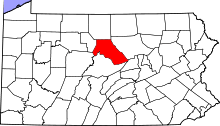 | |
| Boroughs | ||
| Townships | ||
| CDPs | ||
| Unincorporated communities | ||
| Footnotes | ‡This populated place also has portions in an adjacent county | |