Fife Lake, Michigan
| Fife Lake, Michigan | |
|---|---|
| Village | |
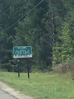 Fife Lake Sign | |
| Motto(s): In the Heart of the Forest... | |
 Location of Fife Lake, Michigan | |
| Coordinates: 44°34′34″N 85°21′6″W / 44.57611°N 85.35167°W | |
| Country | United States |
| State | Michigan |
| County | Grand Traverse |
| Township | Fife Lake |
| Founded | 1872 |
| Founded by | J.L. Shaw |
| Government | |
| • President | Dave McGough |
| Area[1] | |
| • Total | 1.20 sq mi (3.11 km2) |
| • Land | 0.75 sq mi (1.94 km2) |
| • Water | 0.45 sq mi (1.17 km2) |
| Elevation | 1,060 ft (323 m) |
| Population (2010)[2] | |
| • Total | 443 |
| • Estimate (2016)[3] | 469 |
| • Density | 370/sq mi (140/km2) |
| Time zone | UTC-5 (Eastern (EST)) |
| • Summer (DST) | UTC-4 (EDT) |
| FIPS code | 26-28000[4] |
| GNIS feature ID | 0625937[5] |
| Website |
www |
Fife Lake, is a village in Grand Traverse County in the U.S. state of Michigan. The population was 443 at the 2010 census.
The village is situated within Fife Lake Township near the junction of U.S. Route 131 and M-186 (which serves as an eastward extension of M-113).
History
In 1872, J.L. Shaw and others built two small settlements on a lake on the Grand Rapids and Indiana Railroad. These were known as North Fife Lake and Fyfe Lane, which were on the north and west sides of Fife Lake, respectively. Later, in 1867, these villages united. Today on maps, the divide between the former villages is still clearly visible. The lake was named after William H. Fife of nearby Yuba. Later that year, Fife Lake Township was created.[6] The first church in the village was established in 1884.[7]
Geography
According to the United States Census Bureau, the village has a total area of 1.20 square miles (3.11 km2), of which 0.75 square miles (1.94 km2) is land and 0.45 square miles (1.17 km2) is water.[1]
Demographics
| Historical population | |||
|---|---|---|---|
| Census | Pop. | %± | |
| 1890 | 394 | — | |
| 1900 | 456 | 15.7% | |
| 1910 | 340 | −25.4% | |
| 1920 | 215 | −36.8% | |
| 1930 | 227 | 5.6% | |
| 1940 | 303 | 33.5% | |
| 1950 | 347 | 14.5% | |
| 1960 | 218 | −37.2% | |
| 1970 | 274 | 25.7% | |
| 1980 | 402 | 46.7% | |
| 1990 | 394 | −2.0% | |
| 2000 | 466 | 18.3% | |
| 2010 | 443 | −4.9% | |
| Est. 2016 | 469 | [3] | 5.9% |
| U.S. Decennial Census[8] | |||
2010 census
As of the census[2] of 2010, there were 443 people, 189 households, and 110 families residing in the village. The population density was 590.7 inhabitants per square mile (228.1/km2). There were 265 housing units at an average density of 353.3 per square mile (136.4/km2). The racial makeup of the village was 95.7% White, 0.7% African American, 1.6% Native American, and 2.0% from two or more races. Hispanic or Latino of any race were 1.8% of the population.
There were 189 households of which 27.5% had children under the age of 18 living with them, 40.2% were married couples living together, 11.6% had a female householder with no husband present, 6.3% had a male householder with no wife present, and 41.8% were non-families. 30.7% of all households were made up of individuals and 12.1% had someone living alone who was 65 years of age or older. The average household size was 2.34 and the average family size was 2.89.
The median age in the village was 41.1 years. 22.8% of residents were under the age of 18; 6.7% were between the ages of 18 and 24; 25.4% were from 25 to 44; 29.3% were from 45 to 64; and 15.6% were 65 years of age or older. The gender makeup of the village was 49.0% male and 51.0% female.
2000 census
As of the census[4] of 2000, there were 466 people, 185 households, and 120 families residing in the village. The population density was 632.1 per square mile (243.1/km²). There were 256 housing units at an average density of 347.3 per square mile (133.6/km²). The racial makeup of the village was 90.77% White, 0.64% African American, 3.22% Native American, and 5.36% from two or more races. Hispanic or Latino of any race were 0.21% of the population.
There were 185 households out of which 35.7% had children under the age of 18 living with them, 51.4% were married couples living together, 9.7% had a female householder with no husband present, and 34.6% were non-families. 28.1% of all households were made up of individuals and 11.4% had someone living alone who was 65 years of age or older. The average household size was 2.52 and the average family size was 3.07.
In the village, the population was spread out with 28.8% under the age of 18, 7.9% from 18 to 24, 30.5% from 25 to 44, 23.4% from 45 to 64, and 9.4% who were 65 years of age or older. The median age was 35 years. For every 100 females, there were 98.3 males. For every 100 females age 18 and over, there were 96.4 males.
The median income for a household in the village was $32,361, and the median income for a family was $42,188. Males had a median income of $32,083 versus $24,375 for females. The per capita income for the village was $19,024. About 9.4% of families and 13.8% of the population were below the poverty line, including 18.0% of those under age 18 and none of those age 65 or over.
Climate
This climatic region has large seasonal temperature differences, with warm to hot (and often humid) summers and cold (sometimes severely cold) winters. According to the Köppen Climate Classification system, Fife Lake has a humid continental climate, abbreviated "Dfb" on climate maps.[9]
| Climate data for Fife Lake, Michigan | |||||||||||||
|---|---|---|---|---|---|---|---|---|---|---|---|---|---|
| Month | Jan | Feb | Mar | Apr | May | Jun | Jul | Aug | Sep | Oct | Nov | Dec | Year |
| Average high °C (°F) | 12 (54) |
−3 (27) |
−2 (29) |
3 (38) |
12 (53) |
19 (67) |
25 (77) |
27 (81) |
26 (78) |
21 (70) |
14 (58) |
6 (43) |
−1 (31) |
| Average low °C (°F) | −12 (10) |
−13 (8) |
−8 (17) |
−2 (29) |
4 (39) |
9 (49) |
12 (53) |
11 (52) |
8 (46) |
3 (37) |
−3 (27) |
−9 (16) |
0 (32) |
| Average precipitation mm (inches) | 48 (1.9) |
36 (1.4) |
46 (1.8) |
66 (2.6) |
66 (2.6) |
79 (3.1) |
80 (3) |
74 (2.9) |
89 (3.5) |
74 (2.9) |
71 (2.8) |
56 (2.2) |
782 (30.8) |
| Source: Weatherbase [10] | |||||||||||||
Transportation
Major roadways


- CR 605, running as Fife Lake Road, runs towards Williamsburg and Elk Rapids, and M-72 and US 31.
Air travel
- Cherry Capital Airport in Traverse City provides year-round access to Detroit and Chicago.
- Kalkaska City Airport in Kalkaska is a public landing strip
- Whip-Poor-Will Landing Strip is a small private landing strip south of the village in Missaukee County
Railroads
Fife Lake used to be a station on the Grand Rapids and Indiana Railroad.
Notable people
- Jerry Cannon - retired Brigadier General, U.S. Army
 Helen Island in Fife Lake at Sunset
References
- 1 2 "US Gazetteer files 2010". United States Census Bureau. Archived from the original on January 24, 2012. Retrieved 2012-11-25.
- 1 2 "American FactFinder". United States Census Bureau. Retrieved 2012-11-25.
- 1 2 "Population and Housing Unit Estimates". Retrieved June 9, 2017.
- 1 2 "American FactFinder". United States Census Bureau. Archived from the original on September 11, 2013. Retrieved 2008-01-31.
- ↑ "US Board on Geographic Names". United States Geological Survey. 2007-10-25. Retrieved 2008-01-31.
- ↑ http://www.fifelake.com. "Welcome to Fife Lake History". www.fifelake.com. Retrieved 2017-11-18.
- ↑ "About". Village of Fife Lake. Retrieved 2018-03-19.
- ↑ "Census of Population and Housing". Census.gov. Archived from the original on May 12, 2015. Retrieved June 4, 2015.
- ↑ Climate Summary for Fife Lake, Michigan
- ↑ "Weatherbase.com". Weatherbase. 2013. Retrieved on September 22, 2013.
External links
Municipalities and communities of Grand Traverse County, Michigan, United States | ||
|---|---|---|
| City | 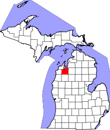 | |
| Villages | ||
| Charter townships | ||
| General law townships | ||
| CDPs | ||
| Other unincorporated communities | ||
| Indian reservation | ||
| Footnotes | ‡This populated place also has portions in an adjacent county or counties | |
Coordinates: 44°34′37″N 85°21′02″W / 44.57694°N 85.35056°W