Ferndale, Washington
| Ferndale, Washington | |
|---|---|
| City | |
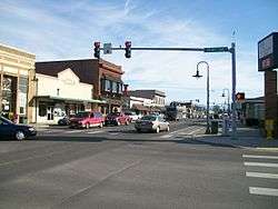 Downtown Ferndale | |
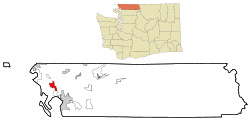 Location of Ferndale, Washington | |
| Coordinates: 48°50′56″N 122°35′25″W / 48.84889°N 122.59028°WCoordinates: 48°50′56″N 122°35′25″W / 48.84889°N 122.59028°W[1] | |
| Country | United States |
| State | Washington |
| County | Whatcom |
| Government | |
| • Mayor | Jon Mutchler |
| • City Council | Rebecca Xczar (Position 1), Greg Hansen (Position 2), Keith Olson (Position 3), Teresa Taylor (Position 4), Cathy Watson (Position 5), Kate Hansen (Position 6), Fred Kennedy (Position 7) |
| Area[2] | |
| • Total | 6.69 sq mi (17.33 km2) |
| • Land | 6.61 sq mi (17.12 km2) |
| • Water | 0.08 sq mi (0.21 km2) |
| Elevation | 36 ft (11 m) |
| Population (2010)[3] | |
| • Total | 11,415 |
| • Estimate (2017)[4] | 14,026 |
| • Density | 1,726.9/sq mi (666.8/km2) |
| Demonym(s) |
Ferndaler, Ferndalian[5] |
| Time zone | UTC-8 (Pacific (PST)) |
| • Summer (DST) | UTC-7 (PDT) |
| ZIP code | 98248 |
| Area code | 360 |
| FIPS code | 53-23620 |
| GNIS feature ID | 1512205[6] |
| Website | City of Ferndale |
Ferndale is a city in Whatcom County, Washington, United States. The population was 11,415 at the 2010 census.[7] It is the third largest city in Whatcom County and borders the Lummi Nation on its southern border.
History
First settled in 1872, Ferndale was given its name because of the ferns that once grew around the original school house.[8] Ferndale was originally called Jam because the town was located next to a log jam on the Nooksack River. The original schoolteacher decided it needed a more picturesque name. Ferndale was officially incorporated on March 19, 1907.
One colorful figure in Ferndale's pioneer past is "Blanket Bill" Jarman (1820–1912) who was once ransomed for a stack of blankets (1848?) and acquitted of homicide (1871). He is buried in Ferndale's Woodlawn Cemetery.[9]
Geography
According to the United States Census Bureau, the city has a total area of 6.69 square miles (17.33 km2), of which, 6.61 square miles (17.12 km2) is land and 0.08 square miles (0.21 km2) is water.[2] Downtown Ferndale is located near the river, along with Griffintown and a largely industrial area east of the Nooksack River. Northwest of these areas are suburban developments.
Demographics
| Historical population | |||
|---|---|---|---|
| Census | Pop. | %± | |
| 1910 | 691 | — | |
| 1920 | 759 | 9.8% | |
| 1930 | 752 | −0.9% | |
| 1940 | 717 | −4.7% | |
| 1950 | 979 | 36.5% | |
| 1960 | 1,442 | 47.3% | |
| 1970 | 2,164 | 50.1% | |
| 1980 | 3,855 | 78.1% | |
| 1990 | 5,398 | 40.0% | |
| 2000 | 8,758 | 62.2% | |
| 2010 | 11,415 | 30.3% | |
| Est. 2016 | 13,403 | [10] | 17.4% |
| U.S. Decennial Census[11] 2014 Estimate[12] | |||
As of 2010 the median household income in the city was $52,831, and the median income for a family was $64,638. Males had a median income of $47,917 versus $37,447 for females. The per capita income for the city was $23,837. About 13.3% of families and 16.8% of the population were below the poverty line, including 24.2% of those under age 18 and 7.3% of those age 65 or over.
2010 census
As of the census[3] of 2010, there were 11,415 people, 4,210 households, and 3,025 families residing in the city. The Washington state Office of Financial Management estimated for its April 1 annual population estimate that Ferndale had grown to 12,710 residents in 2014.[13]
The population density was 1,726.9 inhabitants per square mile (666.8/km2). There were 4,428 housing units at an average density of 669.9 per square mile (258.6/km2). The racial makeup of the city was 83.1% White, 1.0% African American, 2.6% Native American, 3.6% Asian, 0.2% Pacific Islander, 5.2% from other races, and 4.2% from two or more races. Hispanic or Latino of any race were 12.0% of the population.
There were 4,210 households of which 40.8% had children under the age of 18 living with them, 53.7% were married couples living together, 13.6% had a female householder with no husband present, 4.6% had a male householder with no wife present, and 28.1% were non-families. 22.7% of all households were made up of individuals and 9.5% had someone living alone who was 65 years of age or older. The average household size was 2.71 and the average family size was 3.20.
The median age in the city was 34.2 years. 29.1% of residents were under the age of 18; 8.6% were between the ages of 18 and 24; 27.2% were from 25 to 44; 24% were from 45 to 64; and 10.9% were 65 years of age or older. The gender makeup of the city was 48.6% male and 51.4% female.
Climate
Ferndale experiences a mild climate, with no average monthly temperatures above 71.6 °F (22.0 °C). Ferndale is colder and wetter overall than much of the rest of Whatcom County, and has more extreme weather.
Economy
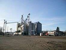
Originally, Ferndale's economy was based on timber, and shortly after, agriculture of the surrounding land. Dairy processing was a significant employer for the town, and the old Carnation dairy plant has since been converted to offices. The construction of the Ferndale Refinery west of town in the 1950s caused a population boom in the town. The Cherry Point Refinery was constructed to the northwest in the 1970s. A shoe manufacturing plant for Brooks Sports, capable of producing 500,000 pairs annual, resides in the city.[14] The city also serves as a bedroom community for Bellingham.
Transportation
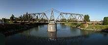
The main highway serving Ferndale is Interstate 5. There are no other state highways in the town. The town also receives industrial rail service through Burlington Northern.
Local culture
Events
- Downtown Trick or Treat in October[15]
- Community Wide Garage Sale (Always the First Saturday of May)[16]
- Annual Citywide Cleanup – Headquartered at City Hall, hosted by the Ferndale Downtown Association (a Saturday in May)
- Chamber of Commerce 'Street Festival' & 'Music Festival' (Held the last weekend of August)
- Old Settlers Picnic, Grand Parade, 5k race (last weekend in July every year)[17]
- Muds To Suds Race
Sister city
Ferndale has the following sister city relationship:

Notable people
- Wendy Lawrence – Retired Astronaut and U.S. Navy captain
- Doug Pederson – Former NFL Quarterback, current Head Coach of the Philadelphia Eagles
- Michael Koenen – Former punter for the Tampa Bay Buccaneers
- Jake Locker – Former NFL quarterback of the Tennessee Titans
- Dennis Erickson – Retired college football and NFL head coach
- Daran Norris – actor, most notably for voice work and a recurring role on the television series Veronica Mars
- Jesse Brand – Nashville songwriter, musician, and actor
References
- ↑ "US Gazetteer files: 2010, 2000, and 1990". United States Census Bureau. February 12, 2011. Retrieved 2011-04-23.
- 1 2 "US Gazetteer files 2010". United States Census Bureau. Archived from the original on July 14, 2012. Retrieved 2012-12-19.
- 1 2 "American FactFinder". United States Census Bureau. Retrieved 2012-12-19.
- ↑ "Population Estimates". United States Census Bureau. Archived from the original on May 22, 2015. Retrieved May 30, 2015.
- ↑ Sam Taylor (April 28, 2008). "Ferndale Skatepark lightning rod volunteer also manning anti-school bond campaign". The Bellingham Herald. Retrieved 2008-10-18.
- ↑ "US Board on Geographic Names". United States Geological Survey. October 25, 2007. Retrieved 2008-01-31.
- ↑ "Ferndale – Census 2010". Spokane Spokesman Review. Retrieved 2011-03-05.
- ↑ Majors, Harry M. (1975). Exploring Washington. Van Winkle Publishing Co. p. 20. ISBN 978-0-918664-00-6.
- ↑ "William Robert "Blanket Bill" Jarman dies in Ferndale on June 12, 1912, in History Link".
- ↑ "Population and Housing Unit Estimates". Retrieved June 9, 2017.
- ↑ United States Census Bureau. "Census of Population and Housing". Archived from the original on May 12, 2015. Retrieved July 21, 2014.
- ↑ "Population Estimates". United States Census Bureau. Archived from the original on May 22, 2015. Retrieved May 30, 2015.
- ↑ http://www.ofm.wa.gov/pop/april1/ofm_april1_population_final.pdf
- ↑ Wahba, Phil (February 1, 2018). "A Kindred Sole". Fortune (Print edition): 30. ISSN 0015-8259.
- ↑ "Ferndale Chamber of Commerce". Archived from the original on December 20, 2010.
- ↑ "Ferndale Chamber of Commerce". Archived from the original on August 9, 2010.
- ↑ "Whatcom County Old Settlers Association".
- ↑ "Sister Relationships".
External links
| Wikimedia Commons has media related to Ferndale, Washington. |
- City of Ferndale Website
- Ferndale Chamber of Commerce
- Ferndale School District
- Bellingham Whatcom County Tourism
- Whatcom County Library System, serving Ferndale and surrounding areas
Municipalities and communities of Whatcom County, Washington, United States | ||
|---|---|---|
| Cities |  | |
| CDPs | ||
| Indian reservations | ||
| Unincorporated communities | ||
| Ghost towns | ||