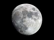
Fermat (crater)
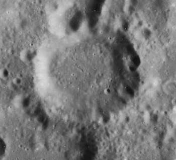 Lunar Orbiter 4 image | |
| Coordinates | 22°43′S 19°47′E / 22.71°S 19.79°ECoordinates: 22°43′S 19°47′E / 22.71°S 19.79°E |
|---|---|
| Diameter | 37.77 km |
| Depth | 2.0 km |
| Colongitude | 20° at sunrise |
| Eponym | Pierre de Fermat |
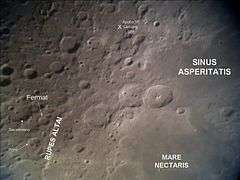
Fermat is a lunar impact crater located to the west of the Rupes Altai escarpment. To the west-southwest is the larger crater Sacrobosco, and to the southwest is the irregular Pons. Also east of the crater is Polybius It is 39 kilometers in diameter and two kilometers deep.[1]
The rim of Fermat is worn and somewhat irregular, but still possesses an outer rampart. The north rim is indented by a double crater formation that includes Fermat A. The floor is relatively flat and does not have a central rise.[2] The crater is from the Pre-Imbrian period, 4.55 to 3.85 billion years ago.[1]
It is named for 17th century French mathematician Pierre de Fermat.[1]
Satellite craters
By convention these features are identified on lunar maps by placing the letter on the side of the crater midpoint that is closest to Fermat.[3]
| Fermat | Coordinates | Diameter |
|---|---|---|
| A | 21°48′S 19°36′E / 21.8°S 19.6°E | 17 km |
| B | 23°00′S 21°06′E / 23.0°S 21.1°E | 11 km |
| C | 21°00′S 18°30′E / 21.0°S 18.5°E | 14 km |
| D | 20°06′S 18°00′E / 20.1°S 18.0°E | 13 km |
| E | 19°54′S 19°54′E / 19.9°S 19.9°E | 7 km |
| F | 22°06′S 20°12′E / 22.1°S 20.2°E | 5 km |
| G | 19°24′S 20°00′E / 19.4°S 20.0°E | 7 km |
| H | 23°06′S 20°42′E / 23.1°S 20.7°E | 5 km |
| P | 23°36′S 19°18′E / 23.6°S 19.3°E | 37 km |
References
- 1 2 3 Autostar Suite Astronomer Edition. CD-ROM. Meade, April 2006.
- ↑ Rükl, Antonín (1990). Atlas of the Moon. Kalmbach Books. ISBN 0-913135-17-8.
- ↑ Bussey, B.; Spudis, P. (2004). The Clementine Atlas of the Moon. New York: Cambridge University Press. ISBN 0-521-81528-2.
External links
| Wikimedia Commons has media related to Fermat (crater). |