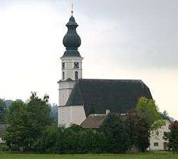
Feldkirchen bei Mattighofen
| Feldkirchen bei Mattighofen | |
|---|---|
 | |
 Feldkirchen bei Mattighofen Location within Austria | |
| Coordinates: 48°04′10″N 13°02′44″E / 48.06944°N 13.04556°ECoordinates: 48°04′10″N 13°02′44″E / 48.06944°N 13.04556°E | |
| Country | Austria |
| State | Upper Austria |
| District | Braunau am Inn |
| Government | |
| • Mayor | Franz Harner (ÖVP) |
| Area | |
| • Total | 34.64 km2 (13.37 sq mi) |
| Elevation | 509 m (1,670 ft) |
| Population (14 June 2016)[1] | |
| • Total | 1,929 |
| • Density | 56/km2 (140/sq mi) |
| Time zone | UTC+1 (CET) |
| • Summer (DST) | UTC+2 (CEST) |
| Postal codes | 5142, 5143 |
| Area code | 07748 |
| Vehicle registration | BR |
| Website | www.feldkirchen-mattighofen.ooe.gv.at |
Feldkirchen bei Mattighofen is a municipality in the Braunau am Inn district in the Austrian state of Upper Austria.
Geography
About 23 percent of the municipality is forest and 70 percent farmland.
References
- ↑ Statistik Austria - Bevölkerung zu Jahresbeginn 2002-2016 nach Gemeinden, Erstellt am 14.06.2016 (Last accessed 13.12.2016) for Feldkirchen bei Mattighofen.
| Wikimedia Commons has media related to Feldkirchen bei Mattighofen. |
This article is issued from
Wikipedia.
The text is licensed under Creative Commons - Attribution - Sharealike.
Additional terms may apply for the media files.