Farris, Oklahoma
| Farris | |
|---|---|
| Unincorporated community | |
 Farris Location within the state of Oklahoma  Farris Farris (the US) | |
| Coordinates: 34°15′45″N 95°52′0″W / 34.26250°N 95.86667°WCoordinates: 34°15′45″N 95°52′0″W / 34.26250°N 95.86667°W | |
| Country | United States |
| State | Oklahoma |
| County | Atoka |
| Time zone | UTC-6 (Central (CST)) |
| • Summer (DST) | UTC-5 (CDT) |
| ZIP code | 74525 |
Farris is a small unincorporated community in Atoka County, Oklahoma, United States. It lies east of the county seat of Atoka on Highway 3 near the county border. From 1914 to 2013, Farris had its own school district with a K-8 school, but after years of declining enrollment, controversies over the district's management, and an "F" rating from the Oklahoma State Department of Education in December 2012,[1] the district voted to dissolve the school district and join the district in nearby Lane, Oklahoma in early 2013.[2] Students above the eighth grade attend Atoka High School in Atoka some twenty miles west of Farris. The post office was established May 17, 1902. It was named for the first postmaster, John L. Farris.[3]
References
- ↑ Megan Rolland, "Two Oklahoma school districts get F's on report card", The Oklahoman, December 10, 2012.
- ↑ Carrie Coppenoll, "Oklahoma school district closes, but questions, lawsuits remain", The Oklahoman, March 4, 2013.
- ↑ George H. Shirk, Oklahoma Place Names (University of Oklahoma Press, 1987), ISBN 978-0806120287, p. 87. Excerpts available at Google Books.
Municipalities and communities of Atoka County, Oklahoma, United States | ||
|---|---|---|
| City | 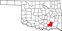 | |
| Towns | ||
| CDP | ||
| Other unincorporated communities | ||
| Ghost towns | ||
This article is issued from
Wikipedia.
The text is licensed under Creative Commons - Attribution - Sharealike.
Additional terms may apply for the media files.