Fara, Orkney
| Norse name | Færey |
|---|---|
| Meaning of name | Island of Sheep (cf Faroe) |
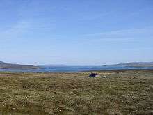
 A fish farm in Gutter Sound, at the western side of Fara | |
| Location | |
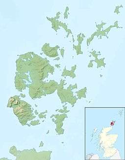 Fara Fara shown within Orkney | |
| OS grid reference | ND325955 |
| Coordinates | 58°51′00″N 3°10′30″W / 58.85°N 3.175°W |
| Physical geography | |
| Island group | Orkney |
| Area | 295 hectares (1.14 sq mi) |
| Area rank | 89 [1] |
| Highest elevation | 43 m (141 ft) |
| Administration | |
| Sovereign state | United Kingdom |
| Country | Scotland |
| Council area | Orkney Islands Council |
| Demographics | |
| Population | 0[2] |
| References | [3][4][5][6] |
An abandoned House on Fara.
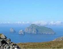
Looking North: Rysa Little with Hoy behind to left; Graemsay with Mainland behind centre and right; Cava to right.
Fara (Old Norse: Færey[5]) is a small island in Orkney, Scotland, lying in Scapa Flow between the islands of Flotta and Hoy. It has been uninhabited since the 1960s.
Footnotes
- ↑ Area and population ranks: there are c. 300 islands over 20 ha in extent and 93 permanently inhabited islands were listed in the 2011 census.
- ↑ National Records of Scotland (15 August 2013) (pdf) Statistical Bulletin: 2011 Census: First Results on Population and Household Estimates for Scotland - Release 1C (Part Two). "Appendix 2: Population and households on Scotland’s inhabited islands". Retrieved 17 August 2013.
- ↑ Haswell-Smith, Hamish (2004). The Scottish Islands. Edinburgh: Canongate. ISBN 978-1-84195-454-7.
- ↑ Ordnance Survey: Landranger map sheet 7 Orkney (Southern Isles) (Map). Ordnance Survey. 2008. ISBN 9780319228135.
- 1 2 Anderson, Joseph (Ed.) (1893) Orkneyinga Saga. Translated by Jón A. Hjaltalin & Gilbert Goudie. Edinburgh. James Thin and Mercat Press (1990 reprint). ISBN 0-901824-25-9
- ↑ Pedersen, Roy (January 1992) Orkneyjar ok Katanes (map, Inverness, Nevis Print)
| Wikimedia Commons has media related to Fara. |
|  | ||||||||||||||||
|
| |||||||||||||||||
| |||||||||||||||||
| |||||||||||||||||
| |||||||||||||||||
| |||||||||||||||||
| |||||||||||||||||
| |||||||||||||||||
Coordinates: 58°50′30″N 3°10′17″W / 58.84163°N 3.17125°W
This article is issued from
Wikipedia.
The text is licensed under Creative Commons - Attribution - Sharealike.
Additional terms may apply for the media files.