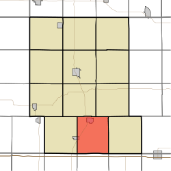
Exira Township, Audubon County, Iowa
| Exira Township, Audubon County | |
|---|---|
| Township | |
 | |
| Coordinates: 41°33′05″N 094°52′40″W / 41.55139°N 94.87778°WCoordinates: 41°33′05″N 094°52′40″W / 41.55139°N 94.87778°W | |
| Country |
|
| State |
|
| County | Audubon |
| Area | |
| • Total | 38.5 sq mi (99.6 km2) |
| • Land | 38.3 sq mi (99.3 km2) |
| • Water | 0.1 sq mi (0.3 km2) |
| Elevation[1] | 1,325 ft (404 m) |
| Population (2010) | |
| • Total | 1,178 |
| • Density | 31/sq mi (11.9/km2) |
| FIPS code | 19-91260[2] |
| GNIS feature ID | 0467804 |
Exira Township is one of twelve townships in Audubon County, Iowa, United States. As of the 2010 census, its population was 1,178.[3]
History
Exira Township was organized in 1874.[4]
Geography
Exira Township covers an area of 38.3 square miles (99.3 km2) and contains two incorporated settlements: Brayton and Exira. According to the USGS, it contains four cemeteries: Bowen, Exira, Holy Trinity and Oakfield.
References
- ↑ "US Board on Geographic Names". United States Geological Survey. 2007-10-25. Retrieved 2008-01-31.
- ↑ "American FactFinder". United States Census Bureau. Archived from the original on 2013-09-11. Retrieved 2008-01-31.
- ↑ "Geographic Identifiers: 2010 Demographic Profile Data (G001): Exira township, Audubon County, Iowa". U.S. Census Bureau, American Factfinder. Retrieved May 9, 2013.
- ↑ Andrews, Henry Franklin (1915). History of Audubon County, Iowa: Its People, Industries, and Institutions. Brookhaven Press. p. 58.
External links
Municipalities and communities of Audubon County, Iowa, United States | ||
|---|---|---|
| Cities | ||
| Townships | ||
| Unincorporated communities | ||
This article is issued from
Wikipedia.
The text is licensed under Creative Commons - Attribution - Sharealike.
Additional terms may apply for the media files.