Erpingham Rural District
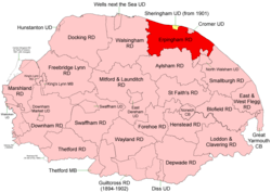 Boundaries in 1894. 1902 extension in yellow |
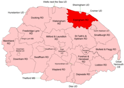 Boundaries in 1935 |
Erpingham Rural District was a rural district in Norfolk, England from 1894 to 1974.[1]
It was formed under the Local Government Act 1894 based on the Erpingham rural sanitary district, taking its name from the ancient North and South Erpingham hundreds - but did not, initially, include some parishes from these hundreds including Erpingham parish itself. It lay on the north coast of Norfolk around the Urban Districts of Cromer and, later, Sheringham (created 1901, extended 1914[2]).
In 1935 Erpingham RD took in several parishes from Aylsham Rural District, and ceded smaller areas to Walsingham and Smallburgh RDs.
In 1974, the district was abolished under the Local Government Act 1972, and became part of the North Norfolk district.
Statistics
| Year | Area (ha) [3] |
Population [4] |
Density (pop/ha) |
|---|---|---|---|
| 1911 | 25,179 | 17,137 | 0.68 |
| 1921 | 25,158 | 17,890 | 0.71 |
| 1931 | 17,018 | 0.68 | |
| 1951 | 28,777 | 19,516 | 0.68 |
| 1961 | 28,773 | 18,479 | 0.64 |
Parishes
| Parish | From | To | Notes |
|---|---|---|---|
| Alby with Thwaite | 1935 | Formerly Aylsham RD | |
| Aldborough | |||
| Antingham | |||
| Aylmerton | |||
| Baconsthorpe | |||
| Barningham Norwood | 1935 | Added to Gresham | |
| Barningham Winter | 1935 | Added to Matlask | |
| Beeston Regis | |||
| Bessingham | 1935 | Added to Sustead | |
| Bodham | |||
| Briston | 1935 | To Walsingham RD | |
| Cley next the Sea | |||
| Colby | 1935 | Formerly Aylsham RD (including Banningham) | |
| Corpusty | 1935 | Formerly Aylsham RD (including Saxthorpe) | |
| East Beckham | |||
| Edgefield | |||
| Erpingham | 1935 | Formerly Aylsham RD (including Calthorpe) | |
| Felbrigg | |||
| Gimingham | |||
| Glandford with Bayfield | 1935 | See Letheringsett with Glandford | |
| Gresham | |||
| Gunton | 1935 | Added to Hanworth | |
| Hanworth | |||
| Hempstead | |||
| High Kelling | |||
| Holt | |||
| Hunworth | 1935 | Added to Stody | |
| Ingworth | 1935 | Formerly Aylsham RD | |
| Itteringham | 1935 | Formerly Aylsham RD (including Mannington) | |
| Kelling | |||
| Knapton | 1935 | To Smallburgh RD | |
| Letheringsett | 1935 | See Letheringsett with Glandford | |
| Letheringsett with Glandford | 1935 | Merger of Letheringsett and Glandford with Bayfield | |
| Little Barningham | 1935 | Formerly Aylsham RD | |
| Matlask | |||
| Metton | 1935 | Added to Sustead | |
| Mundesley | |||
| Northrepps | |||
| Overstrand | |||
| Plumstead | |||
| Roughton | |||
| Runton | |||
| Salthouse | |||
| Sheringham | 1901 | Partly formed Sheringham UD, rest as Upper Sheringham | |
| Sidestrand | |||
| Southrepps | |||
| Stody | |||
| Suffield | |||
| Sustead | |||
| Thornage | |||
| Thorpe Market | |||
| Thurgarton | 1935 | Added to Aldborough | |
| Trimingham | |||
| Trunch | 1935 | To Smallburgh RD | |
| Upper Sheringham | 1901 | Formerly part of Sheringham parish | |
| West Beckham | |||
| Weybourne | |||
| Wickmere | Formerly Aylsham RD (including Wolterton) |
References
- ↑ "Erpingham RD through time: Census tables with data for the Local Government District". A Vision of Britain through Time. GB Historical GIS / University of Portsmouth. Retrieved 30 June 2017.
- ↑ "Sheringham CP/AP through time: Census tables with data for the Parish-level Unit". A Vision of Britain through Time. GB Historical GIS / University of Portsmouth. Retrieved 30 June 2017.
- ↑ "Erpingham through time: Population Statistics: Area (acres)". A Vision of Britain through Time. GB Historical GIS / University of Portsmouth. Retrieved 30 Jun 2017.
- ↑ "Erpingham through time: Population Statistics: Total Population". A Vision of Britain through Time. GB Historical GIS / University of Portsmouth. Retrieved 30 Jun 2017.
This article is issued from
Wikipedia.
The text is licensed under Creative Commons - Attribution - Sharealike.
Additional terms may apply for the media files.