End Hill
| End Hill | |
|---|---|
 End Hill | |
| Highest point | |
| Elevation | 329 m (1,079 ft) [1] |
| Coordinates | 52°07′10.42″N 2°20′29.64″E / 52.1195611°N 2.3415667°ECoordinates: 52°07′10.42″N 2°20′29.64″E / 52.1195611°N 2.3415667°E |
| Geography | |
| Location | Malvern Hills, England |
| Topo map | OS Landranger 150 |
| Geology | |
| Age of rock | Pre-Cambrian |
| Mountain type | Igneous, Metamorphic |
| Climbing | |
| Easiest route | Hiking |
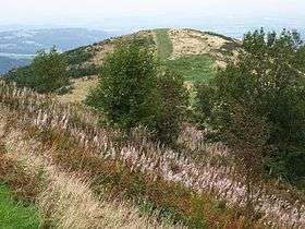
End Hill is the northernmost top of the Malvern Hills that runs approximately 13 kilometres (8 mi) north-south along the Herefordshire-Worcestershire border. It lies north of Table Hill and north-northwest of North Hill. It has an elevation of 329 metres (1,079 ft).[1]
References
- 1 2 "Identification of key views to and from the Malvern Hills Area of Outstanding Natural Beauty A Report prepared by Cooper Partnership for The Malvern Hills AONB Partnership" (PDF). malvernhillsaonb.org.uk. The Malvern Hills AONB Partnership. March 2009. p. Appendix Table L2: Assessment of Views from and within Malvern Hills AONB. Retrieved 11 August 2015.
This article is issued from
Wikipedia.
The text is licensed under Creative Commons - Attribution - Sharealike.
Additional terms may apply for the media files.