Swinyard Hill
| Swinyard Hill | |
|---|---|
 Swinyard Hill | |
| Highest point | |
| Elevation | 272 m (892 ft) OS 1:10,000 map series, Sheet 1, North Malvern to Wyche. |
| Coordinates | 52°02′54″N 2°20′43″W / 52.04833°N 2.34528°WCoordinates: 52°02′54″N 2°20′43″W / 52.04833°N 2.34528°W |
| Geography | |
| Location | Malvern Hills, England |
| Topo map | OS Landranger 150 |
| Geology | |
| Age of rock | Pre-Cambrian |
| Mountain type | Igneous, Metamorphic |
| Climbing | |
| Easiest route | Hiking |
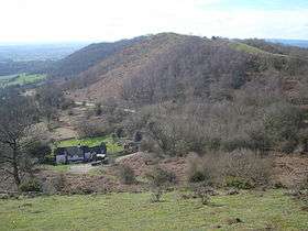
Swinyard Hill is a hill in the Malvern Range, a line of hills that runs approximately 13 kilometres (8 mi) north-south along the Herefordshire-Worcestershire border. Swinyard Hill lies north of Midsummer Hill and south of Hangmans Hill. It has an elevation of 272 metres (892 ft).
References
This article is issued from
Wikipedia.
The text is licensed under Creative Commons - Attribution - Sharealike.
Additional terms may apply for the media files.