Elwood, Iowa
| Elwood, Iowa | |
|---|---|
| Unincorporated community | |
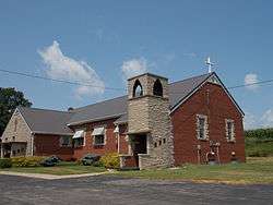 Elwood United Methodist Church | |
 Elwood, Iowa Location within the state of Iowa | |
| Coordinates: 41°59′30″N 90°44′21″W / 41.99167°N 90.73917°WCoordinates: 41°59′30″N 90°44′21″W / 41.99167°N 90.73917°W | |
| Country | United States |
| State | Iowa |
| County | Clinton |
| Elevation | 738 ft (225 m) |
| Time zone | UTC-6 (Central (CST)) |
| • Summer (DST) | UTC-5 (CDT) |
| Area code(s) | 563 |
| GNIS feature ID | 456353[1] |
Elwood is an unincorporated community in northwestern Clinton County, Iowa, United States. It lies along Iowa Highway 136 northwest of the city of Clinton, the county seat of Clinton County, and 5 miles (8 km) east of Lost Nation.[2] Its elevation is 738 feet (225 m).[1] It once possessed a post office, established in 1871.[3] Elwood was named in honor of Kinsey Elwood who platted the town in 1873.[4]
References
- 1 2 "Elwood, Iowa". Geographic Names Information System. United States Geological Survey.
- ↑ Rand McNally. The Road Atlas '09. Chicago: Rand McNally, 2009, p. 39.
- ↑ U.S. Geological Survey Geographic Names Information System: Elwood Post Office
- ↑ Wolfe's History of Clinton County, 1911, p. 271.
Municipalities and communities of Clinton County, Iowa, United States | ||
|---|---|---|
| Cities | ||
| Townships | ||
| Unincorporated communities | ||
| Footnotes | ‡This populated place also has portions in an adjacent county or counties | |
This article is issued from
Wikipedia.
The text is licensed under Creative Commons - Attribution - Sharealike.
Additional terms may apply for the media files.