Elmhurst Township, Lackawanna County, Pennsylvania
| Elmhurst Township | |
|---|---|
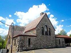 Cross Road Assembly of God Church | |
.svg.png) Location of Pennsylvania in the United States | |
| Coordinates: 41°22′00″N 75°32′59″W / 41.36667°N 75.54972°WCoordinates: 41°22′00″N 75°32′59″W / 41.36667°N 75.54972°W | |
| Country | United States |
| State | Pennsylvania |
| County | Lackawanna |
| Area[1] | |
| • Total | 1.94 sq mi (5.01 km2) |
| • Land | 1.84 sq mi (4.78 km2) |
| • Water | 0.09 sq mi (0.24 km2) |
| Elevation | 1,581 ft (482 m) |
| Population (2010) | |
| • Total | 894 |
| • Estimate (2016)[2] | 857 |
| • Density | 464.75/sq mi (179.40/km2) |
| Time zone | UTC-5 (EST) |
| • Summer (DST) | UTC-4 (EDT) |
| Area code(s) | 570 |
| FIPS code | 42-069-23336 |
Elmhurst Township is a township in Lackawanna County, Pennsylvania, United States. The population was 894 at the 2010 census.
Geography
According to the United States Census Bureau, the township has a total area of 1.9 square miles (4.9 km2), of which, 1.8 square miles (4.7 km2) of it is land and 0.1 square miles (0.26 km2) of it (4.23%) is water. The township is surrounded by Roaring Brook Township. Hence, Elmhurst Township is an enclave of Roaring Brook Township.
Demographics
| Historical population | |||
|---|---|---|---|
| Census | Pop. | %± | |
| 2010 | 894 | — | |
| Est. 2016 | 857 | [2] | −4.1% |
| U.S. Decennial Census[3] | |||
2010 census
As of the census[4] of 2010, there were 894 people, 330 households, and 216 families residing in the township. The population density was 496.6 people per square mile. There were 348 housing units at an average density of 193.3/sq mi. The racial makeup of the township was 98.4% White, 0.3% African American and 0.1% Asian. Hispanic or Latino of any race were 1.1% of the population.
There were 330 households, out of which 17.4% had children under the age of 18 living with them, 51.5% were married couples living together, 8.8% had a female householder with no husband present, and 34.5% were non-families. 31.2% of all households were made up of individuals, and 22.1% had someone living alone who was 65 years of age or older. The average household size was 2.39 and the average family size was 3.
In the township the population was spread out, with 18.7% under the age of 18, 50.4% from 18 to 64, and 30.9% who were 65 years of age or older. The median age was 50 years.
The median income for a household in the township was $39,821, and the median income for a family was $73,750. Males had a median income of $49,219 versus $37,778 for females. The per capita income for the township was $22,070. About 5.4% of families and 4.5% of the population were below the poverty line, including 4.2% of those under age 18 and 9.1% of those age 65 or over.
2000 census
As of the census[5] of 2000, there were 838 people, 258 households, and 198 families residing in the township. The population density was 462.5 people per square mile (178.8/km²). There were 274 housing units at an average density of 151.2/sq mi (58.4/km²). The racial makeup of the township was 99.88% White and 0.12% African American. Hispanic or Latino of any race were 0.24% of the population.
There were 258 households, out of which 32.6% had children under the age of 18 living with them, 64.0% were married couples living together, 8.9% had a female householder with no husband present, and 22.9% were non-families. 19.4% of all households were made up of individuals, and 11.2% had someone living alone who was 65 years of age or older. The average household size was 2.64 and the average family size was 3.01.
In the township the population was spread out, with 17.2% under the age of 18, 6.8% from 18 to 24, 21.5% from 25 to 44, 22.8% from 45 to 64, and 31.7% who were 65 years of age or older. The median age was 48 years. For every 100 females there were 72.1 males. For every 100 females age 18 and over, there were 70.9 males.
The median income for a household in the township was $47,917, and the median income for a family was $49,861. Males had a median income of $39,583 versus $25,625 for females. The per capita income for the township was $17,465. About 1.0% of families and 1.6% of the population were below the poverty line, including 2.2% of those under age 18 and 4.8% of those age 65 or over.
References
- ↑ "2016 U.S. Gazetteer Files". United States Census Bureau. Retrieved Aug 14, 2017.
- 1 2 "Population and Housing Unit Estimates". Retrieved June 9, 2017.
- ↑ "Census of Population and Housing". Census.gov. Retrieved June 4, 2016.
- ↑ "American FactFinder". United States Census Bureau. Archived from the original on 2013-09-11. Retrieved 2011-05-14.
- ↑ "American FactFinder". United States Census Bureau. Archived from the original on 2013-09-11. Retrieved 2008-01-31.
Municipalities and communities of Lackawanna County, Pennsylvania, United States | ||
|---|---|---|
| Cities | 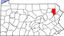 | |
| Boroughs | ||
| Townships | ||
| CDPs | ||
| Unincorporated communities |
| |