Ellerhoop
| Ellerhoop | ||
|---|---|---|
| ||
 Ellerhoop Location of Ellerhoop within Pinneberg district 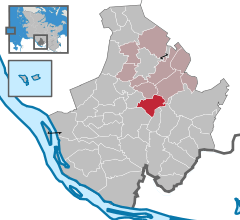  | ||
| Coordinates: 53°43′39″N 9°46′14″E / 53.72750°N 9.77056°ECoordinates: 53°43′39″N 9°46′14″E / 53.72750°N 9.77056°E | ||
| Country | Germany | |
| State | Schleswig-Holstein | |
| District | Pinneberg | |
| Municipal assoc. | Rantzau | |
| Government | ||
| • Mayor | Wiebke Uhl (CDU) | |
| Area | ||
| • Total | 10.8 km2 (4.2 sq mi) | |
| Elevation | 11 m (36 ft) | |
| Population (2016-12-31)[1] | ||
| • Total | 1,434 | |
| • Density | 130/km2 (340/sq mi) | |
| Time zone | CET/CEST (UTC+1/+2) | |
| Postal codes | 25373 | |
| Dialling codes | 04120 | |
| Vehicle registration | PI | |
| Website | www.ellerhoop.de | |

Ellerhoop is a municipality in the district of Pinneberg in Schleswig Holstein, Germany. It is twinned with the village of Hurst Green, East Sussex, UK.
Geography
Ellerhoop is situated to the north of Hamburg, close to the A23 Autobahn.
Points of interest
References
| Authority control |
|---|
This article is issued from
Wikipedia.
The text is licensed under Creative Commons - Attribution - Sharealike.
Additional terms may apply for the media files.