Elk Falls Township, Elk County, Kansas
| Elk Falls Township | |
|---|---|
| Township | |
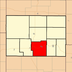 Location in Elk County | |
| Coordinates: 37°20′45″N 096°12′27″W / 37.34583°N 96.20750°WCoordinates: 37°20′45″N 096°12′27″W / 37.34583°N 96.20750°W | |
| Country | United States |
| State | Kansas |
| County | Elk |
| Area | |
| • Total | 58.72 sq mi (152.07 km2) |
| • Land | 58.61 sq mi (151.79 km2) |
| • Water | 0.11 sq mi (0.28 km2) 0.18% |
| Elevation | 974 ft (297 m) |
| Population (2000) | |
| • Total | 196 |
| • Density | 3.3/sq mi (1.3/km2) |
| GNIS feature ID | 0469873 |
Elk Falls Township is a township in Elk County, Kansas, United States. As of the 2000 census, its population was 196.
Geography
Elk Falls Township covers an area of 58.72 square miles (152.1 km2) and contains one incorporated settlement, Elk Falls. According to the USGS, it contains one cemetery, Mount Olivet.
The streams of South Fork Wildcat Creek and Wildcat Creek run through this township.
Transportation
Elk Falls Township contains one airport or landing strip, Elk County Airport.
References
External links
Municipalities and communities of Elk County, Kansas, United States | ||
|---|---|---|
| Cities | 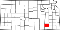 | |
| Unincorporated communities | ||
| Townships | ||
This article is issued from
Wikipedia.
The text is licensed under Creative Commons - Attribution - Sharealike.
Additional terms may apply for the media files.