El Bosque Airport
| El Bosque Airport Base Aérea El Bosque | |||||||||||
|---|---|---|---|---|---|---|---|---|---|---|---|
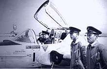 El Bosque Air Base, 1965 | |||||||||||
| Summary | |||||||||||
| Airport type | Military | ||||||||||
| Owner/Operator | Chilean Air Force | ||||||||||
| Serves | Santiago, Chile | ||||||||||
| Location | El Bosque | ||||||||||
| Coordinates | 33°33′39″S 70°41′15″W / 33.56083°S 70.68750°WCoordinates: 33°33′39″S 70°41′15″W / 33.56083°S 70.68750°W | ||||||||||
| Map | |||||||||||
 SCBQ Location of El Bosque Airport in Chile | |||||||||||
| Runways | |||||||||||
| |||||||||||
El Bosque Airport (Spanish: Base Aérea El Bosque) (es) (ICAO: SCBQ), is a military airport located in El Bosque, a southern suburb of Santiago, Chile.
Runway 03 has an additional 250 metres (820 ft) displaced threshold. The El Bosque VOR-DME (Ident: BQE) is located on the field.[4] There is distant high terrain northeast through southeast.
See also


- Transport in Chile
- List of airports in Chile
References
- ↑ DGAC IFIS (Internet Flight Information System) (in Spanish)
- ↑ Airport information for SCBQ at Great Circle Mapper.
- ↑ Google Maps - El Bosque Air Base
- ↑ El Bosque VOR
External links
- OpenStreetMap - El Bosque
- OurAirports - El Bosque
- SkyVector - El Bosque
- Airport information for El Bosque Airport at World Aero Data. Data current as of October 2006.
- Accident history for El Bosque Airport at Aviation Safety Network
This article is issued from
Wikipedia.
The text is licensed under Creative Commons - Attribution - Sharealike.
Additional terms may apply for the media files.