Edgecumbe
| Edgecumbe | |
|---|---|
| Minor urban area | |
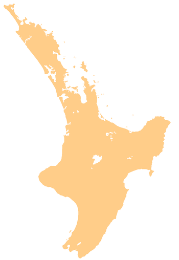 Edgecumbe Edgecumbe's location within the North Island | |
| Coordinates: 37°58.5′S 176°49.5′E / 37.9750°S 176.8250°ECoordinates: 37°58.5′S 176°49.5′E / 37.9750°S 176.8250°E | |
| Country | New Zealand |
| Region | Bay of Plenty |
| Territorial authority | Whakatane District |
| Ward | Rangitāiki |
| Population (June 2017)[1] | |
| • Total | 1,790 |
| Postcode(s) | 3120 |
Edgecumbe is a town in the Bay of Plenty of the North Island of New Zealand, 15 kilometres to the west of Whakatane and eight kilometres south of the Bay's coast.
It is the main service town for the agricultural region surrounding the plains of the Rangitaiki River, which flows through the town.
It had a population of 1626 in the 2006 New Zealand Census[2] but it has since increased to 1,638 as of the 2013 Census.[3]
State Highway 2 and the Taneatua Branch railway line (disused) pass through the town.
History
The town is named after the small village of Edgecumbe in Cornwall, United Kingdom, between Penryn and Helston. Edgecumbe was linked with Tauranga and Auckland by rail, with the opening of the East Coast Main Trunk Railway and Taneatua Express in 1928.
In 1987, a large earthquake centered on Edgecumbe shook the Bay of Plenty, causing widespread damage and causing much of the population to leave Edgecumbe.
In July 2004, May 2005 and April 2017, the town experienced heavy flooding that ruined many homes.[4] In the 2005 flood, the river swelled to within 5 cm of breaching the flood banks that had been put in place seven years prior.
1987 Edgecumbe earthquake
The earthquake was a major turning point in the history of Edgecumbe. It measured 6.3 on the Richter magnitude scale and struck the Bay of Plenty region of New Zealand on 2 March 1987, just after 1.42 pm. The earthquake was very shallow, being centred approximately 8 km from the Earth's surface. The earthquake was one of the most damaging New Zealand's North Island has experienced in recent decades, with approximately 50% of the houses in Edgecumbe being damaged by the quake. There was extensive damage to a local milk factory, with large storage tanks toppled. Kawerau was another nearby town that suffered damage and Whakatane was also badly shaken. An 80-tonne New Zealand Railways DC class locomotive was thrown onto its side.
The earthquake caused no fatalities.[5][6][7]
However, one person died at the time as a result of a heart attack, possibly due to the quake.[8] A foreshock just minutes before had cut the power supply and many people had moved away from heavy machinery and out of their houses. The largest aftershock was measured at 5.2 and struck at 1.52 pm.
A crack 7 kilometres (4.3 mi) long opened in the Rangitaiki Plains near Edgecumbe, as a result of the earthquake. It is now known as the 'Edgecumbe Fault'. At one point, the land close to the fault dropped 2 metres (6.6 ft).
The epicentre of the quake was approximately 2.24 kilometres (1.39 mi) south-south-east of the town of Matata, or 15 kilometres (9.3 mi) north-north-west of Edgecumbe. The intense ground-shaking caused by the earthquake led to a large number of ground surface failures, including sand boils, ridge-top shatters and debris avalanches on steeper slopes.[9] Because of the earthquake, many people left and therefore Edgecumbe's population dropped considerably. Edgecumbe is slowly recovering as it has increased by 21 in the years 2006 to 2013, possibly due to many kiwifruit orchards being affected by PSA.
2017 Edgecumbe flood
In April 2017, remnants of Cyclone Debbie caused heavy rainfall in the region. At 8:30 am on April 6, water from the Rangitaiki River breached a stopbank next to Edgecumbe, causing widespread flooding across the township.[10] A state of emergency was declared for the Whakatane District, and around 2000 people were evacuated to Kawerau and Whakatane.[10][11] More than 300 homes were damaged, with some becoming uninhabitable. [12]
The largest animal rescue in New Zealand history was recorded during the aftermath of the flood. Approximately 1000 animals were rescued by an SPCA led operation, with support from local civil defence rescue teams and veterinarians from Massey University. The event highlighted a significant gap in animal welfare emergency management capability in New Zealand.[13]
Geography
Edgecumbe is located inland from the coast on the end of the fertile Rangitaiki Plains. The nearby beach is part of Maketu. The volcanic cone of Mount Edgecumbe, 15 kilometres to the south and close to the town of Kawerau, is visible from Edgecumbe.
Attractions
Fonterra Dairy Factory
Established in 1915, the Edgecumbe Dairy Factory is one of the oldest dairy factories still running in New Zealand. The factory employs 358 people, accounting for roughly 1/5 of Edgecumbe's total population.[14]
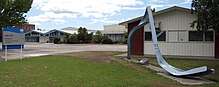
Edgecumbe College
Edgecumbe College is located at 100 College Rd, Edgecumbe.[15]
Clubs and organisations
The Association Football Club Plains Rangers AFC[16] is based at the Edgecumbe Domain, along with rugby and hockey.
The Edgecumbe Volunteer Fire Brigade[17] is located on SH2 and services the township and surrounding area.
Edgecumbe has a long-established rugby football club.
Kartsport has its Eastern Bay of Plenty track at Edgecumbe.
Notable people
- Eve Rimmer, paraplegic athlete
References
- ↑ "Subnational Population Estimates: At 30 June 2017 (provisional)". Statistics New Zealand. 24 October 2017. Retrieved 24 October 2017. For urban areas, "Subnational population estimates (UA, AU), by age and sex, at 30 June 1996, 2001, 2006-16 (2017 boundary)". Statistics New Zealand. 24 October 2017. Retrieved 24 October 2017.
- ↑ "QuickStats About Edgecumbe". Stats.govt.nz. Retrieved 20 June 2015.
- ↑ "North Island (New Zealand): Regions & Settlements – Population Statistics in Maps and Charts". Citypopulation.de. Retrieved 20 June 2015.
- ↑ "Disaster Mitigation Projects". Whakatane District Council. Archived from the original on 27 June 2009. Retrieved 28 July 2009.
- ↑ McSaveney, Eileen (1 December 2010). "Historic earthquakes – The 1987 Edgecumbe earthquake". Te Ara – the Encyclopedia of New Zealand. Archived from the original on 7 January 2011. Retrieved 13 February 2011.
- ↑ "1987 Edgecumbe earthquake" (PDF). Rumblings Issue 19. Earthquake Commission. July 2009. Archived from the original (PDF) on 2 January 2011. Retrieved 13 February 2011.
- ↑ "M 6.5, Edgecumbe, March 2, 1987". GeoNet. Archived from the original on 5 March 2011. Retrieved 13 February 2011.
- ↑ "Earthquake: Edgecumbe". Christchurch City Libraries. Retrieved 13 February 2011.
- ↑ Franks, C.A.M. (1988). "Engineering geological aspects of the Edgecumbe, New Zealand earthquake of 2 March 1987". Quarterly Journal of Engineering Geology. 21 (4): 337–345. doi:10.1144/GSL.QJEG.1988.021.04.06.
- 1 2 "Edgecumbe evacuates as water swamps the town - National - NZ Herald News". Nzherald.co.nz. 2017-04-06. Retrieved 2017-04-08.
- ↑ "State of emergency declared". SunLive. 2017-04-06. Retrieved 2018-07-05.
- ↑ "Edgecumbe flood anniversary: A year of highs and lows". Nzherald.co.nz. 2018-03-31. Retrieved 2018-07-05.
- ↑ Glassey, Steve (28 October 2017). "SPCA Rescue: Operation Edgecumbe 2017 After Action Report". Wellington SPCA. Retrieved 28 October 2017.
- ↑ "Edgecumbe". Fonterra. Retrieved 20 June 2015.
- ↑ "Edgecumbe College – Contact". Edgecumbe College. Retrieved 2017-04-08.
- ↑ "Gary Fowell Builders Plains Rangers A.F.C." Archived from the original on 26 October 2009.
- ↑ "Home – Edgecumbe Fire Brigade". Freewebs.com. Archived from the original on 11 June 2015. Retrieved 20 June 2015.