East Nassau, New York
| East Nassau | |
|---|---|
| Village | |
 Location in Rensselaer County and the state of New York. | |
 East Nassau Location within the state of New York | |
| Coordinates: 42°31′44″N 73°30′58″W / 42.52889°N 73.51611°WCoordinates: 42°31′44″N 73°30′58″W / 42.52889°N 73.51611°W | |
| Country | United States |
| State | New York |
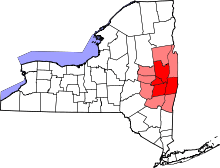
| County | Rensselaer |
| Incorporated | 1998 |
| Area | |
| • Total | 4.9 sq mi (12.7 km2) |
| • Land | 4.9 sq mi (12.7 km2) |
| • Water | 0.0 sq mi (0.0 km2) |
| Elevation | 571 ft (174 m) |
| Population (2010)[1] | |
| • Total | 587 |
| • Estimate (2016)[2] | 567 |
| • Density | 120/sq mi (46/km2) |
| Time zone | UTC-5 (Eastern (EST)) |
| • Summer (DST) | UTC-4 (EDT) |
| Area code(s) | 518 |
| FIPS code | 36-22557 |
| GNIS feature ID | 0949185 |
East Nassau is a village in Rensselaer County, New York, United States. The population was 587 at the 2010 census.[1]
The Village of East Nassau is in the east part of the town of Nassau along the Town of Stephentown border by Routes 20 and 66.
History
The community was first known as "Schermerhorn's" after an early inhabitant. East Nassau incorporated as a village in 1998.[3]
The East Nassau Central School was listed on the National Register of Historic Places in 1997.[4]
Geography
East Nassau is located at 42°31′44″N 73°30′58″W / 42.52889°N 73.51611°W (42.528830, -73.515997).[5]
According to the United States Census Bureau, the village has a total area of 4.9 square miles (13 km2), all of it land.
Demographics
| Historical population | |||
|---|---|---|---|
| Census | Pop. | %± | |
| 1870 | 192 | — | |
| 1880 | 88 | −54.2% | |
| 2000 | 571 | — | |
| 2010 | 587 | 2.8% | |
| Est. 2016 | 567 | [2] | −3.4% |
| U.S. Decennial Census[6] | |||
As of the census of 2000, there were 571 people, 216 households, and 150 families residing in the village. The population density was 116.6 people per square mile (45.0/km²). There were 255 housing units at an average density of 52.1 per square mile (20.1/km²). The racial makeup of the village was 96.32% White, 0.88% African American, 1.58% Asian, 0.18% from other races, and 1.05% from two or more races. Hispanic or Latino of any race were 0.88% of the population.[1]
There were 216 households out of which 32.9% had children under the age of 18 living with them, 60.2% were married couples living together, 5.6% had a female householder with no husband present, and 30.1% were non-families. 23.6% of all households were made up of individuals and 9.3% had someone living alone who was 65 years of age or older. The average household size was 2.64 and the average family size was 3.18.[1]
In the village, the population was spread out with 28.4% under the age of 18, 4.0% from 18 to 24, 30.1% from 25 to 44, 22.1% from 45 to 64, and 15.4% who were 65 years of age or older. The median age was 38 years. For every 100 females, there were 100.4 males. For every 100 females age 18 and over, there were 96.6 males.[1]
The median income for a household in the village was $42,250, and the median income for a family was $48,125. Males had a median income of $35,750 versus $30,893 for females. The per capita income for the village was $24,740. About 2.7% of families and 7.9% of the population were below the poverty line, including 9.4% of those under age 18 and 6.0% of those age 65 or over.[1]
Government
The village is governed by a Mayor-Council form of government. The mayor is elected every two years during even number years. Village trustees are elected for two year terms that overlap.
The current Mayor is Mitchell Levin. Village trustees are Adam Acquario (term expires 2015), Thomas Kernan (term expires 2015), William Davis (term expires 2016) and Lydia Davis (term expires 2016).
References
- 1 2 3 4 5 6 "American FactFinder". United States Census Bureau. Archived from the original on 2013-09-11. Retrieved 2008-01-31.
- 1 2 "Population and Housing Unit Estimates". Retrieved June 9, 2017.
- ↑ "Village of East Nassau: Homepage". Retrieved 2010-02-17.
- ↑ National Park Service (2010-07-09). "National Register Information System". National Register of Historic Places. National Park Service.
- ↑ "US Gazetteer files: 2010, 2000, and 1990". United States Census Bureau. 2011-02-12. Retrieved 2011-04-23.
- ↑ "Census of Population and Housing". Census.gov. Archived from the original on May 12, 2015. Retrieved June 4, 2015.
Further reading
- Anderson, George Baker (1897). Landmarks of Rensselaer County New York. Syracuse, New York: D. Mason and Company. OCLC 1728151.
- Hayner, Rutherford (1925). Troy and Rensselaer County New York: A History. New York: Lewis Historical Publishing Company, Inc. OCLC 22524006.
- Sylvester, Nathaniel Bartlett (1880). History of Rensselaer Co., New York with Illustrations and Biographical Sketches of its Prominent Men and Pioneers. Philadelphia: Everts & Peck. OCLC 3496287.
- Weise, Arthur James (1880). History of the Seventeen Towns of Rensselaer County from the Colonization of the Manor of Rensselaerwyck to the Present Time. Troy, New York: J. M. Francis & Tucker. OCLC 6637788.
External links
| Wikimedia Commons has media related to East Nassau, New York. |
Municipalities and communities of Rensselaer County, New York, United States | ||
|---|---|---|
| Cities | 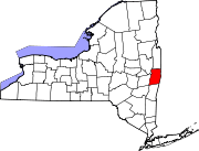 | |
| Towns | ||
| Villages | ||
| CDPs | ||
| Other hamlets | ||