East Malvern railway station
East Malvern | |||||||||||
|---|---|---|---|---|---|---|---|---|---|---|---|
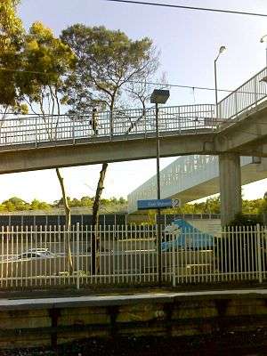 Platform 2 in December 2009 with new footbridge over the Monash Freeway | |||||||||||
| Location |
Sylvester Crescent, Malvern East Australia | ||||||||||
| Coordinates | 37°52′37″S 145°04′10″E / 37.87694°S 145.06933°ECoordinates: 37°52′37″S 145°04′10″E / 37.87694°S 145.06933°E | ||||||||||
| Owned by | VicTrack | ||||||||||
| Operated by | Metro Trains | ||||||||||
| Line(s) | Glen Waverley | ||||||||||
| Distance | 13.75 kilometres from Southern Cross | ||||||||||
| Platforms | 2 side | ||||||||||
| Tracks | 2 | ||||||||||
| Connections | Bus | ||||||||||
| Construction | |||||||||||
| Structure type | Ground | ||||||||||
| Parking | 676 | ||||||||||
| Bicycle facilities | Yes | ||||||||||
| Disabled access | Yes | ||||||||||
| Other information | |||||||||||
| Status | Premium station | ||||||||||
| Station code | EMV | ||||||||||
| Fare zone | Myki zone 1/2 overlap | ||||||||||
| Website | Public Transport Victoria | ||||||||||
| History | |||||||||||
| Opened | 3 February 1929 | ||||||||||
| Electrified | Yes | ||||||||||
| Services | |||||||||||
| |||||||||||
East Malvern railway station is located on the Glen Waverley line, in Victoria, Australia, and serves the eastern Melbourne suburb of Malvern East. It opened on 3 February 1929 as Eastmalvern, and was renamed East Malvern in February 1972.[1]
The line originally terminated at Darling, but East Malvern became the terminus for just over a year after it opened, until the extension to Glen Waverley opened on 5 May 1930.[2][3]
During part of the 1950s and 1960s, there was a short extra platform at the down end of Platform 1, making ⅓ of it an island platform. Trains of from one to three cars could fit alongside the platform, but it usually accommodated a single swing door ("dogbox") or Tait car,[4] which ran an East Malvern to Glen Waverley shuttle, because most trains at night and on weekends terminated at East Malvern. Only every second or third train connected with the Glen Waverley shuttle.
The current station buildings were provided in 1975.[5] Parcel facilities were also abolished around this time.[6]
The Monash Freeway overpass, located at the down end of the station, was provided around 1987/1988.[7] This required the slewing of the line through an artificial tunnel whilst the freeway was under construction, and the replacement of a wooden trestle bridge, which crossed over a local creek.[8]
East Malvern was upgraded to a Premium station on 21 August 1995.[9] The footbridge, located at the down end of the station, was replaced in 2009, to accommodate the widening of the Monash Freeway.[10]
Platforms & services
East Malvern has two side platforms. It is served by Metro Trains' Glen Waverley line trains.[11]
Platforms 1:
- Glen Waverley line: all stations and limited stops services to Flinders Street
Platform 2:
- Glen Waverley line: all stations services to Glen Waverley
Transport links
CDC Melbourne operates one route via East Malvern station, under contract to Public Transport Victoria:
References
- ↑ East Malvern Vicsig
- ↑ Infrastructure - East Malvern Vicsig
- ↑ An early photograph of a single-car swing door Tait train on the line to Mount Waverley.
- ↑ The "little train", as referred to by locals, a single-car swing door ("dogbox") Tait train, on its service between East Malvern and Glen Waverly, 1960s
- ↑ "Glen Waverley". Victorian Railways. VicRail. July 1975. p. 103.
- ↑ "Traffic". Newsrail. Australian Railway Historical Society. March 1975. p. 68.
- ↑ "Works". Newsrail. Australian Railway Historical Society. March 1988. p. 93.
- ↑ "Works". Newsrail. Australian Railway Historical Society. April 1988. p. 123.
- ↑ "Upgrading Eltham to a Premium Station". Newsrail. Australian Railway Heritage Society. October 1997. p. 310.
- ↑ East Malvern Bridge Upgrade Improving Transport Links Premier of Victoria 20 August 2009
- ↑ Glen Waverley Line timetable Public Transport Victoria
- ↑ Route 612 Box Hill - Chadstone timetable Public Transport Victoria
External links

- Melway map