Eakring
| Eakring | |
|---|---|
 Eakring – Savile Arms | |
 Eakring Eakring shown within Nottinghamshire | |
| Population | 395 (2001)[1] |
| OS grid reference | SK673623 |
| District | |
| Shire county | |
| Region | |
| Country | England |
| Sovereign state | United Kingdom |
| Post town | NEWARK |
| Postcode district | NG22 |
| Dialling code | 01623 |
| Police | Nottinghamshire |
| Fire | Nottinghamshire |
| Ambulance | East Midlands |
| EU Parliament | East Midlands |
| UK Parliament | |
Eakring is a village and civil parish in the Newark and Sherwood district of Nottinghamshire, England, whose population at the 2011 Census was 419.[2]
Geography
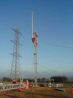
The village lies between the A617[3] and the A616 roads between Ollerton and Southwell. Dukes Wood to the south is situated on the top of an escarpment, giving good views over the Trent valley to the east and towards Southwell to the south. Clouds formed by the Cottam Power Station are often seen on clear days to the north-east. A steep hill descends into the village from the south, on which the road passes a large residential training centre for National Grid plc.[4]
Heritage
The village pub is the Savile Arms on Bilsthorpe Road. The Robin Hood Way passes through the village.
Eakring Mill was a five-storey brick tower windmill, built some time after 1840 (grid reference SK673628). The sails were removed in 1912 and the mill was derelict by 1936. It was converted to a house in about 1995.[5] A windmill was shown on a map of 1832, located in Mill Hill Field, where two footpaths cross, (grid reference SK668616) and another windmill shown north of Eakring Brail Wood (grid reference SK662614).
The parish church[6] is dedicated to St Andrew. The grade II* listed structure was constructed in the 13th–15th centuries and restored in the early 1880s, when the seating was replaced. It contains a font bearing the date 1674, and a plaque commemorating the installation of the tower clock in 1887.[7]
Notable people
In birth order:
- Reverend William Mompesson, vicar of Eyam during the Plague in 1666, moved to the village in 1670, lived there for 39 years, and was buried in the churchyard.
- John Michell (1724–1793), cleric and natural philosopher, was born in Eakring. He made notable discoveries in astronomy, geology, optics and gravitation.[8]
- Helen Cresswell, children's writer, died in Eakring on 26 September 2005.[9]
World War II oil
Geological survey
In the late 1930s oil exploration was undertaken by the D'Arcy Exploration Co Ltd, part of the Anglo-Iranian Oil Company Ltd. Using geological data from colliery workings, geologists calculated that an anticline was situated under Eakring. A nearby borehole at Kelham had produced oil. Drilling to levels between 7463 ft and 7468 ft had found significant quantities of oil – which turned out to be particularly significant when the Second World War and the U-Boat campaign started.
Drilling
Wells also produced oil at Caunton and Kelham Hills. The oil had a specific gravity of 0.86 – which is high-grade oil. The UK typically had oil reserves of 5 million barrels (790,000 m3), which were under strength. In March 1943, production began at around 100 wells, being coordinated by Philip Southwell, a petroleum engineer from the D'Arcy Oil Company who had liaised with Lloyd Noble, president of Noble Drilling Corporation in Oklahoma. Throughout the operation, the location[10] of the oilfield was kept secret. American oil workers lived in the Anglican monastery at Kelham Hall.[11] In total, the oilfield produced around 3.5 million barrels (560,000 m3) of oil throughout the war. In contrast, the Germans had to rely on synthetic oil, manufacture of which largely ceased during 1944 as a result of Allied bombing raids. This speeded up the capitulation of the Luftwaffe. By 1964, the wells had produced 47 million barrels (7,500,000 m3).
References
- ↑ "Parish Headcounts: Eakring CP". Neighbourhood Statistics. Office for National Statistics. Retrieved 15 April 2007.
- ↑ "Civil Parish 2011". Neighbourhood Statistics. Office for National Statistics. Retrieved 7 April 2016.
- ↑ "SK6758 : Kirklington Road". geograph.org.uk. 2005. Retrieved 10 December 2010.
- ↑ "SK6761 : Building pylons at Eakring training centre". geograph.org.uk. 2004. Retrieved 10 December 2010.
- ↑ Shaw, T. (1995). Windmills of Nottinghamshire. Nottingham: Nottinghamshire County Council. p. 14. ISBN 0-900986-12-3.
- ↑ "SK6762 : St. Andrew's Church, Eakring, Notts". geograph.co.uk. 2005. Retrieved 10 December 2010.
- ↑ Historic England. "Church of St Andrew Eakring (241865)". Images of England. Retrieved 16 June 2011.
- ↑ "On-line: SCIENCE AND TECHNOLOGY". Exnet.com. Retrieved 6 October 2014.
- ↑ "BBC Genome listing for 'Down Your Way'". BBC. 1989. Retrieved 1 November 2015.
- ↑ "SK6860 : Nodding Donkey, Dukes Wood Nature Reserve". geograph.org.uk. 2005. Retrieved 10 December 2010.
- ↑ "History of the Eakring Oilfield". dukeswoodoilmuseum.co.uk. Retrieved 10 December 2010.
External links
| Wikimedia Commons has media related to Eakring. |
- A news item: Villagers oppose drilling in November 2003
- Guy H. Woodward & Grace Steele Woodward (2002). The Secret of Sherwood Forest: Oil production in England during World War II. University of Oklahoma Press. ISBN 0-8061-3433-X.
- Village website
- St Andrews church
- Notts history
- History of the Eakring Oilfield
- Sherwood Forest's Secret Oil
- Brief history with map of Eakring oilfield
- Map of Dukes Wood