Duston
| Duston | |
|---|---|
 Typical buildings on Main Road, in the village | |
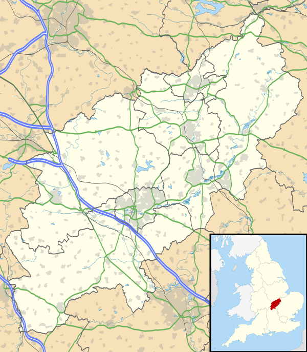 Duston Duston shown within Northamptonshire | |
| Population |
15,565 [1] 15,498 (2011 census) |
| OS grid reference | SP7261 |
| District | |
| Shire county | |
| Region | |
| Country | England |
| Sovereign state | United Kingdom |
| Post town | Northampton |
| Postcode district | NN5 |
| Dialling code | 01604 |
| Police | Northamptonshire |
| Fire | Northamptonshire |
| Ambulance | East Midlands |
| EU Parliament | East Midlands |
| UK Parliament | |
Duston is a suburb of and civil parish in the borough of Northampton, Northamptonshire, England.
It has been a settlement since at least the Roman times, and grew as a village in the Saxon times. In the Domesday Book, Duston was recorded as a farming community. St Luke's Church was built in the 12th century and has many medieval features. The old village was built up around this and has gradually moved westwards along Main Road.
Since the 1950s, the historical village has been engulfed on all sides by the expansion of Northampton. Most development in Duston has been residential, but the original village still contains many of its old buildings within its nucleus and is now a conservation area. The civil parish population was 15,498 at the 2011 census.[2]
History
Archaeological remains found in the area suggest that Duston has roots in Prehistoric and Roman settlements. However, development in the area has meant that it is now difficult to find further remains.[3]
Early Extractive Industries
Iron ore was first quarried in the district in 1854 and 1855 to the east of the village on land leased from Viscount Palmerston and from Duston Church (St Luke's.) At that time the ore was quarried mostly to the south of the Northampton to Daventry road, but also on the other side. The quarry was connected by railway to the Northampton branch of the canal,close to Duston Mill where the ore trucks were emptied into canal boats for transport to an ironworks eksewhere.The trucks descended when full by gravity and when emptied were hauled back to the quarry by horses. The quarry was re-opened in 1859 and the railway was extended under the road as the quarry was extended on that side. Steam locomotives were used on the railway from 1861 onwards. Quarrying finished on the south side of the road in 1905 and on the north side of the road in 1908.
There was also a limestone quarry to the north side of Bants Lane which closed by 1901. It was connected to the railway by a narrow gauge tramway. Limestone trucks were emptied into standard gauge trucks in the iron ore quarry.
A branch of the railway connected with a claypit and brickworks and an iron foundry in the St James district of Northampton. By 1883 the sidings next to the canal were closed and the line extended across the canal to sidings on the Northampton to Blisworth railway,close to the Hunsbury Ironworks. The iron ore quarry site is now built on, being the site of an industrial and retail estate. Most of the course of the railway southwards was obliterated when the area was dug for gravel in the 1960s and by the construction of the Northampton Town Football Ground .The bridge over the canal (altered) is still there. A quarry face still remains close to Duston Road
Part of the limestone quarry was incorporated into the British Timken site in 1941.[4]
Governance
The Duston parish is split into two wards for local governance. Duston returns four councillors in elections to the Northampton Borough Council split over two wards. The north-western side from the mini-roundabout at the Berrywood Road/Main Road junction to the northern edge of the Borough forms the New Duston ward (represented by Matthew Golby and John Caswell, both Conservative). The remainder of the parish from the mini-roundabout and down to the other side of the Sixfields retail park at the A4500 forms the Old Duston ward (represented by Timothy Hadland and Suresh Patel, again both Conservative).
Similarly, for elections to the Northamptonshire County Council, the area north from the same mini-roundabout up and east of Main Road - and including the recently developed St Crispin estate - forms the Duston West and St Crispin ward (represented by Matthew Golby, a Conservative). The remaining Duston East ward is composed of the rest of the parish and settlements past Bants Lane up to Weedon Road, and is represented by Suresh Patel, a Conservative.
The entirety of the Duston parish sits in the Northampton South parliamentary constituency, currently represented by David Mackintosh of the Conservative Party.
Economy
.jpg)
British Timken was previously a major employer in Duston. Established in Chester Road, Aston, Birmingham in 1937 manufacturing tapered roller, parallel roller and ball bearings. In World War II a shadow factory was built in 1941 on a green-field site in Main Road, Duston, to produce roller bearings. At its peak over 4,000 people were employed in the factory. In 2002 the works were closed and the site cleared for housing with production moving to Poland.[5][6] British Timken was a division of the (then) Timken Bearing Company of Canton Ohio, now The Timken Company.
Duston also benefits from its proximity to the Sixfields Leisure retail park, which includes a Cineworld cinema and the Sixfields Stadium - home to the Northampton Town Football Club ("the Cobblers"), a Sainsbury's supermarket and several restaurants and pubs. Blacks Leisure Group (owner of Blacks and Millets) is based on an industrial estate on Mansard Close. On the north-eastern side of the area lies the Lodge Farm industrial estate, where major employers include builders merchants Travis Perkins, XPO Logistics, and a Debenhams distribution centre.
From 1876 to 1995 Duston was home to St Crispin's Hospital, a county-owned and subsequently NHS mental hospital. During the First World War it was turned into Duston War Hospital for convalescent soldiers.
Education
There are a mixture of both secondary and primary schools in Duston. In addition to the secondary school, there are five primary schools located within the Duston boundary. Duston Eldean Primary School lies between the northern section of Main Road and Firsview Drive. Millway Primary School is situated in the south-eastern end of the parish on Millway near to the Sixfields retail park and Stadium. Hopping Hill Primary School is another community primary school, situated on Pendle Road close to the Duston Library and Limehurst Square shopping precinct. Chiltern Primary School is positioned on the north-east of the area on Chiltern Way. The St Luke's CEVA Primary School, while connected to the St Luke's church on Main Road, is actually located outside of Duston and instead in the neighbouring St Crispin area.
There is one all-through school in the civil parish, The Duston School, located towards the south-western end on Berrywood Road. Formerly named Duston Upper School prior to the abolition of middle schools in Northamptonshire, the school is co-educational and serves a teaching school for student teachers. In addition to its 4-16 provision, the Duston School also contains a small sixth form centre offering A-Levels, BTECs and other vocational courses. Outside of the parish, there are a number of nearby schools parents may send their children to. In terms of secondary education, Quinton House School is located nearby in the Upton area, directly south of Duston. Further afield, the Northampton School for Boys and Northampton School for Girls, situated near the areas of Abington and Spinney Hill respectively, are also options for parents. Additional secondary schools located within a commutable distance to Duston include Campion School in Bugbrooke, Malcolm Arnold Academy in Queen's Park and Abbyfield School in Mereway.
Geography
Neighbouring areas of Duston. | ||||||||||
|---|---|---|---|---|---|---|---|---|---|---|
| ||||||||||
References
- ↑ Office for National Statistics: Duston CP: Parish headcounts. Retrieved 9 November 2009
- ↑ "Civil Parish population 2011". Neighbourhood Statistics. Office for National Statistics. Retrieved 2 July 2016.
- ↑ "Duston | British History Online". www.british-history.ac.uk. Institute of Historical Research, University of London. Retrieved 3 February 2017.
- ↑ Tonks, Eric (1989). The Ironstone Quarries of the Midlands. Cheltenham: Runpast. pp. 90–105. ISBN 1 870754 03 4.
- ↑ British Industrial History accessed 1 January 2012
- ↑ British Timken to axe 950 jobs BBC News 26 April 2001, accessed 1 January 2012
External links
![]()
The Borough of Northampton | |||||||||||
|---|---|---|---|---|---|---|---|---|---|---|---|
| Suburbs and villages | 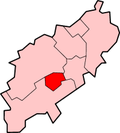 | ||||||||||
| Governance | |||||||||||
| Culture |
| ||||||||||
| Education | |||||||||||
| Sport |
| ||||||||||
| Transport | |||||||||||
| |||||||||||