Dumarao, Capiz
| Dumarao | |
|---|---|
| Municipality | |
| Municipality of Dumarao | |
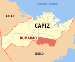 Map of Capiz with Dumarao highlighted | |
.svg.png) Dumarao Location within the Philippines | |
| Coordinates: 11°16′N 122°41′E / 11.27°N 122.68°ECoordinates: 11°16′N 122°41′E / 11.27°N 122.68°E | |
| Country |
|
| Region | Western Visayas (Region VI) |
| Province | Capiz |
| District | 2nd district of Capiz |
| Barangays | 33 (see Barangays) |
| Government [1] | |
| • Type | Sangguniang Bayan |
| • Mayor | Edgardo M. Arancillo |
| • Electorate | 26,194 voters (2016) |
| Area [2] | |
| • Total | 232.56 km2 (89.79 sq mi) |
| Population (2015 census)[3] | |
| • Total | 46,157 |
| • Density | 200/km2 (510/sq mi) |
| Time zone | UTC+8 (PST) |
| ZIP code | 5812 |
| PSGC | 061904000 |
| IDD : area code | +63 (0)36 |
| Climate type | Tropical climate |
| Income class | 2nd municipal income class |
| Revenue (₱) | 117,998,413.17 (2016) |
| Native languages |
Kinaray-a language Capiznon Hiligaynon Ati Tagalog |
| Website |
www |
Dumarao, officially the Municipality of Dumarao, is a 2nd class municipality in the province of Capiz, Philippines. According to the 2015 census, it has a population of 46,157 people.[3]
It is 45 kilometres (28 mi) from Roxas City.
It was founded in 1580 and established by Spaniards under the advocacy of Our Lady of Snows.
Barangays
Dumarao is politically subdivided into 33 barangays. [2]
- Agbatuan
- Aglalana
- Aglanot
- Agsirab
- Alipasiawan
- Astorga
- Bayog
- Bungsuan
- Calapawan
- Codingle
- Cubi
- Dacuton
- Dangula
- Gibato
- Guinotos
- Jambad
- Janguslob
- Lawaan
- Malonoy
- Nagsulang
- Ongol Ilawod
- Ongol Ilaya
- Poblacion Ilawod
- Poblacion Ilaya
- Sagrada Familia
- Salcedo
- San Juan
- Sibariwan
- Tamulalod
- Taslan
- Tina
- Tinaytayan
- Traciano / Agsalay
Demographics
| Population census of Dumarao | ||
|---|---|---|
| Year | Pop. | ±% p.a. |
| 1903 | 5,479 | — |
| 1918 | 7,428 | +2.05% |
| 1939 | 14,298 | +3.17% |
| 1948 | 16,308 | +1.47% |
| 1960 | 19,231 | +1.38% |
| 1970 | 22,422 | +1.55% |
| 1975 | 27,338 | +4.06% |
| 1980 | 29,934 | +1.83% |
| 1990 | 36,801 | +2.09% |
| 1995 | 38,037 | +0.62% |
| 2000 | 40,303 | +1.25% |
| 2007 | 42,603 | +0.77% |
| 2010 | 43,986 | +1.17% |
| 2015 | 46,157 | +0.92% |
| Source: Philippine Statistics Authority[3] [4] [5] [6] | ||
In the 2015 census, the population of Dumarao was 46,157 people,[3] with a density of 200 inhabitants per square kilometre or 520 inhabitants per square mile.
References
- ↑ "Municipality". Quezon City, Philippines: Department of the Interior and Local Government. Retrieved 31 May 2013.
- 1 2 "Province: Capiz". PSGC Interactive. Quezon City, Philippines: Philippine Statistics Authority. Retrieved 12 November 2016.
- 1 2 3 4 Census of Population (2015). "Region VI (Western Visayas)". Total Population by Province, City, Municipality and Barangay. PSA. Retrieved 20 June 2016.
- ↑ Census of Population and Housing (2010). "Region VI (Western Visayas)". Total Population by Province, City, Municipality and Barangay. NSO. Retrieved 29 June 2016.
- ↑ Censuses of Population (1903–2007). "Region VI (Western Visayas)". Table 1. Population Enumerated in Various Censuses by Province/Highly Urbanized City: 1903 to 2007. NSO.
- ↑ "Province of Capiz". Municipality Population Data. Local Water Utilities Administration Research Division. Retrieved 17 December 2016.
External links
Places adjacent to Dumarao, Capiz | |
|---|---|
Roxas (capital) | |
| Municipalities | |
| Component city | |
This article is issued from
Wikipedia.
The text is licensed under Creative Commons - Attribution - Sharealike.
Additional terms may apply for the media files.