Drummoyne, New South Wales
- For the seat in the New South Wales Legislative Assembly, see Electoral district of Drummoyne.
| Drummoyne Sydney, New South Wales | |||||||||||||||
|---|---|---|---|---|---|---|---|---|---|---|---|---|---|---|---|
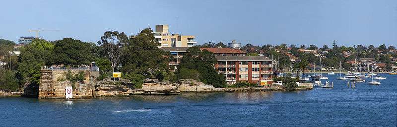
 Apartments on the Parramatta River, Drummoyne | |||||||||||||||
| Population | 11,950 (2016 census)[1] | ||||||||||||||
| • Density | 5,173/km2 (13,400/sq mi) | ||||||||||||||
| Established | 1890 | ||||||||||||||
| Postcode(s) | 2047 | ||||||||||||||
| Area | 2.31 km2 (0.9 sq mi) | ||||||||||||||
| LGA(s) | City of Canada Bay | ||||||||||||||
| State electorate(s) | Drummoyne | ||||||||||||||
| Federal Division(s) | |||||||||||||||
| |||||||||||||||
Drummoyne is a suburb in the Inner West[2] of Sydney, in the state of New South Wales, Australia. Drummoyne is 6 kilometres west of the Sydney central business district and is the administrative centre for the local government area of the City of Canada Bay.
Drummoyne sits on the peninsula between Iron Cove and Five Dock Bay. It is surrounded on three sides by Sydney Harbour and the Parramatta River and, as such, has some of Sydney's best waterfront views. Drummoyne neighbours the similarly historic Five Dock and Abbotsford.
History
William Wright, a merchant, whaler and sealer bought land in the northern part of the area in 1853. The property was bounded by present-day Lyons Road and Victoria Road.[3] Drummoyne House was built in the Georgian Classical style. It was rectangular in plan with a hipped roof with a concave verandah across the entire front and returned along each side.[3] He named it Drummoyne Park after his family home at Drummoyne on Clyde in Scotland. In Gaelic, Drummoyne means flat topped ridge.[4]
Heritage listings
Drummoyne has a number of heritage-listed sites, including:
- Rawson Avenue: Drummoyne Reservoir[5]
Population
Demographics
In the 2016 census of Population and Housing, the population of Drummoyne stood at 11,950 people, 53.0% females and 47.0% males, with a median age of 40 years. 63.5% of people were born in Australia. The most common countries of birth were England 4.3%, Italy 2.4%, New Zealand 2.3%, China 1.9% and Greece 1.1%. 71.1% of people only spoke English at home. Other languages spoken at home included Italian 3.8%, Greek 3.1%, Mandarin 1.9%, Cantonese 1.5% and Spanish 1.2%. The most common responses for religion in Drummoyne (State Suburbs) were Catholic 31.3%, No Religion 26.8% and Anglican 11.9%. [1]
Drummoyne's population is wealthier than the Australian average, with a median weekly household income of $2,353, compared with $1,438 in Australia. 65.3% of the suburbs occupied private dwellings were family households, 27.9% were lone person households and 6.8% were group households.[1]
Notable residents
- James Magnussen, Olympic swimmer and gold medallist
- Anthony Field, the blue wiggle
- Donald Munro Shand, grazier and airline founder[6]
Michael Pate the actor lived in Drummoyne.
Politics
Drummoyne is now part of the City of Canada Bay, a municipality formed in 2000 by the amalgamation of the municipalities of Drummoyne and Concord. It is part of the NSW Legislative Assembly electoral district of Drummoyne whose current member is John Sidoti MP. It is in the Federal electorate of Reid and is represented in Federal parliament by Craig Laundy. However Drummoyne's polling places return Liberal Party of Australia majorities POLLING PLACE - DRUMMOYNE EASTPOLLING PLACE - DRUMMOYNE.
Transport
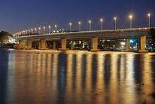
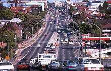
Drummoyne is linked to Rozelle by the Victoria Road and Huntleys Point by the Gladesville Bridge. Victoria Road, one of Sydney's busiest roads, cuts through the heart of Drummoyne en route to the Sydney CBD. Victoria Road's presence makes the CBD transport hub extremely accessible, as numerous and frequent State Transit bus routes from Sydney's west merge in Drummoyne. However, it also leads to a bottleneck during the morning and evening peaks.
Regular Sydney Ferries Rivercat services from the Wolseley Street wharf also provide a transport option for Drummoyne residents, servicing the Parramatta-City route.[7]
Commercial area
Drummoyne is mostly residential with some commercial developments, and still retains some of its industrial heritage. The main shopping strip is located along Victoria Road and the intersecting Lyons Road featuring Australia’s largest party store, The Party People as well as restaurants, home improvement stores and specialty shops. There is also a small shopping plaza at this point. A shopping mall is located at Birkenhead Point, known as the Birkenhead Point Outlet Centre, featuring a Coles supermarket, specialty shops and factory outlet stores. The Canada Bay Civic Centre, the administration building for the City of Canada Bay, is located in Marlborough Street.
Sport
Drummoyne Rowing Club, formed in 1919, is one of four rowing clubs on Iron Cove in Sydney Harbour. It has occupied its current site at Sister's Bay, Drummoyne since its foundation.
Drummoyne is home to Drummoyne Oval, situated on the banks of the Parramatta River. In 1931, as a depression project, Drummoyne Oval was constructed on the site of a small oval which the Glebe and Balmain Rugby Union Clubs had used for junior matches since 1892. To ensure longevity of tenure, because there were not enough sporting grounds in Sydney, the Glebe Balmain Club decided to change its name to the Drummoyne District Rugby Football Club. It did so without giving up its long-held traditions, the scarlet jumpers of Glebe and its tag, "The Dirty Reds" and the black and gold of Balmain, colours still worn by today's players on their socks. The Drummoyne Rugby Club still plays at Drummoyne Oval as it has done for many years and is its permanent home.[8]
Drummoyne Oval is also a permanent home to Sydney first grade cricket side Balmain-UTS during the summer and occasionally hosts the NSW Blues Cricket side in the national ING Cup competition. With a carpet-like playing surface and large capacity (approximately 8,000), the oval is often used for cricket, Australian rules football and Rugby Union.
Drummoyne Olympic pool is located on the banks of Iron Cove. Filtered chlorine is separated from open water by 3 metres of poolside deck.
The Bay Run is a popular route for runners and walkers.

Churches
- St Bede's Anglican Church
Designed in 1931 by Emil Sodersten - St Mark's Catholic Church
Where the series Correlli was filmed - Drummoyne Presbyterian Church
- Drummoyne Baptist Church
Schools and colleges
Gallery
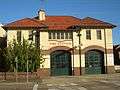 Fire Station, Lyons Road
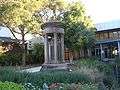 War Memorial, Marlborough Street
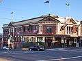 P.J. Gallagher's Irish pub
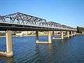
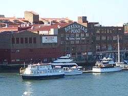 Birkenhead Point shopping centre
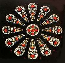 The waratah window of St Bede's Anglican Church, by Alfred Handel.
References
- 1 2 3 Australian Bureau of Statistics (27 June 2017). "Drummoyne (State Suburb)". 2016 Census QuickStats. Retrieved 14 August 2017.

- ↑ Australian Suburb Guide: Sydney Inner West Archived 26 December 2012 at the Wayback Machine. Retrieved 7 August 2013.
- 1 2 Drummoyne Municipal Council Drummoyne Heritage Study Specialist Report, pp. 9-10
- ↑ Frances Pollon, The Book of Sydney Suburbs, Angus and Robertson, 1990, pages 86-88
- ↑ "Drummoyne Reservoir, New South Wales State Heritage Register (NSW SHR) Number H01625". New South Wales State Heritage Register. Office of Environment and Heritage. Retrieved 18 May 2018.
- ↑ "Australian Dictionary of Biography". adb.anu.edu.au. Retrieved 2015-08-03.
- ↑ "Archived copy". Archived from the original on 18 February 2011. Retrieved 2011-04-10.
- ↑ The Dirty Reds Est. 1874
External links
| Wikimedia Commons has media related to Drummoyne, New South Wales. |
Coordinates: 33°51′13″S 151°09′14″E / 33.85352°S 151.15402°E