Downsville, Wisconsin
| Downsville, Wisconsin | |
|---|---|
| Census-designated place | |
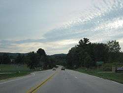 Looking south at the sign for Downsville on Wisconsin Highway 25 | |
 Downsville Location within the state of Wisconsin | |
| Coordinates: 44°46′29″N 91°55′55″W / 44.77472°N 91.93194°WCoordinates: 44°46′29″N 91°55′55″W / 44.77472°N 91.93194°W | |
| Country | United States |
| State | Wisconsin |
| County | Dunn |
| Town | Dunn |
| Area | |
| • Total | 0.805 sq mi (2.08 km2) |
| • Land | 0.758 sq mi (1.96 km2) |
| • Water | 0.047 sq mi (0.12 km2) |
| Population (2010) | |
| • Total | 146 |
| • Density | 180/sq mi (70/km2) |
| Time zone | UTC-6 (Central (CST)) |
| • Summer (DST) | UTC-5 (CDT) |
| Area code(s) | 715 & 534 |
| Historical population | |||
|---|---|---|---|
| Census | Pop. | %± | |
| 2010 | 146 | — | |
Downsville is an unincorporated census-designated place in the town of Dunn, in Dunn County, Wisconsin, United States.[1][2] The community was founded at a crossing of the Red Cedar River in 1855. As of the 2010 census, its population was 146.[3]
The Empire in Pine Museum is located in Downsville. About 3 miles south of the community lies the girlhood home of Caddie Woodlawn, preserved at the Caddie Woodlawn Park.
Notes
External links
Municipalities and communities of Dunn County, Wisconsin, United States | ||
|---|---|---|
| City | 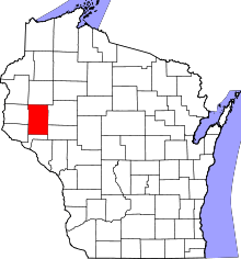 | |
| Villages | ||
| Towns | ||
| CDPs | ||
| Unincorporated communities | ||
| Ghost towns/neighborhoods | ||
| Footnote | ‡This populated place also has portions in an adjacent county or counties | |
This article is issued from
Wikipedia.
The text is licensed under Creative Commons - Attribution - Sharealike.
Additional terms may apply for the media files.