Doonside, New South Wales
| Doonside Sydney, New South Wales | |||||||||||||||
|---|---|---|---|---|---|---|---|---|---|---|---|---|---|---|---|
Kildare_Road_Doonside.jpg) Kildare Road, Doonside | |||||||||||||||
| Population | 13,451 (2016 census)[1] | ||||||||||||||
| Established | 1929 | ||||||||||||||
| Postcode(s) | 2767 | ||||||||||||||
| Location | 40 km (25 mi) west of Sydney CBD | ||||||||||||||
| LGA(s) | City of Blacktown | ||||||||||||||
| State electorate(s) | Blacktown | ||||||||||||||
| Federal Division(s) | Chifley | ||||||||||||||
| |||||||||||||||
Doonside is a suburb in Sydney, in the state of New South Wales, Australia. Doonside is located 40 kilometres west of the Sydney central business district, in the local government area of the City of Blacktown and is part of the Greater Western Sydney region. Featherdale Wildlife Park and the Nurragingy Nature Reserve are popular local tourist attractions
History
The Original Land Owners
The Duruk people were once the owners of local land. The area now known as Doonside was named 'Bungarribee' (Bung meaning the 'creek' and garribee meaning 'cockatoo').[2]
In 1802, Governor Philip Gidley King reserved a large proportion of land for a Government Stock Reserve. The next twenty years saw Doonside as grazing land for cattle and sheep by convict herdsmen. In 1822 part of the Government stock run (operating locally since 1813) was granted by Governor Thomas Brisbane to Scottish immigrant, Robert Crawford. Robert first named his 1,000 acre (4 km²) grant "Milton" (1822), then "Hill End" (1823), after his family home in Greenock Scotland, which overlooked the River Clyde. Three generations of the Crawford family had resided at Hill End (or Hillend) in Greenock.[3] In Sydney, Robert Crawford possibly modelled his villa "Clydebank" on his Georgian styled Greenock home.[3] The grant in NSW (always known as Hill End or Hillend), was enlarged in 1826 with the acquisition of Joseph Bigge's 300 acre grant facing Richmond Road.[3] Crawford likely named this Doonside, after the birthplace of the famed poet Robert Burns (1759-96), beside the River Doon in Ayrshire. It's not been established if Robert Crawford was related to the then owner a Mr Crauford, who is mentioned in the earliest publications about Burns.[3] Crawford's homestead and land (south of the railway) continued to be known as Hill End into the 1930s, when acquired by Thomas R. Cleaver (1868-1948) of Bungarribee.[3] Before the homestead's demolition for War Service Homes,[3] the region had various names, including Crawford, before officially becoming Doonside.[4]
Robert James Crawford (1799-1848) had four children with Mary Campbell (d. 1832): Mary Crawford (b. 1826), Robert Crawford (1827-1906), George Canning Crawford (b. 1828), and Agnes C. Crawford (b. 1831). (Robert Crawford's four children's names are used today at Crawford Public School as sporting house teams). The elder Robert Crawford married Miss Jones of Bligh Street, Sydney, in 1832.
Robert Crawford (1827-1906) married Victoria Margaret Smyth in 1868. Their son, Robert (1868-1930), born in the same year became a published poet.[5]
Bungarribee House
.jpg)
In 1822 the area south of Hill End (Doonside) was granted to a Scottish-born settler named John Campbell (1770-1827).[6] Like Crawford, Campbell erected a homestead of a similar design, along with numerous outbuildings utilising convict and free employees. The house was "scarcely completed" at the time of Campbell's death in October 1827, and was extended by Thomas Icely (1797-1874) following his purchase of the property in 1828.[7]
The property and house had a series of owners and tenants in the 19th and 20th centuries until acquired by the Commonwealth Overseas Telecommunications Commission (OTC) in 1950. The house, deliberately left to decay, was demolished in May 1957 by OTC.[7] The newly formed National Trust had been trying to secure a lease from OTC, but upon advising they wanted to re-roof the house, OTC arbitrarily objected on frivolous grounds. Following this, the house was suddenly trashed ending leasing negotiations. Demolition tenders were advertised by OTC soon after. A small protest by local residents and interested parties were unable to save the homestead.[8]
Wolkara
The Doonside name was changed briefly in 1921 to an Aboriginal name ‘Wolkara’ When the new railway station was being constructed, Wolkara was also the name of the post office that opened here in 1921, but in April 1929 it was changed back to Doonside, after local residents protested at the name change.[9]
Early Doonside
There was no electricity until 1929 and water was drawn from wells. Horse-drawn carts would deliver bread and meat. Blacktown was visited by train as there weren't any buses or schools. Parramatta and Penrith, were the nearest high schools.
A store and post office were opened unofficially in 1926 by Bill Francis on the corner of Hillend Road and Cross Street. For some years his nephew Jack Francis operated the post office on the other side of the railway line but once it was made official it returned to its original site until 1987.
In 1955 electric trains came to Doonside and Edith Crawford from the founding family, also being the oldest inhabitant, was given the privilege of 'cutting the ribbon'. Her death was in 1956.
At the time of World War 1
Prior to 1916, the only development at Doonside was confined to the Crawford family. The Crawford homestead and acreage block was on the south side of the railway line facing Doonside Road. Kelburn Crawford's daughters house, was between the homestead and Bungarribee. North of the line on the corner of Hillend Road and Doonside Crescent, was a brick cottage owned by the Italian family, Luparno. Opposite was a small gatekeepers cottage.
A brick home, owned by another Crawford daughter, was in Doonside Crescent. Properties fronted Hillend Road and were owned by Crawford children. Another cottage in Hillend Road was owned by the family named Harrison, in-laws to Crawford children. A workman's timber cottage was on the hill towards the tileworks' site.
The only road into Doonside was Doonside Road, running from Western Highway. Hillend Road only went as far as Power Street after which there was a track to Richmond Road ending in a gate. Power Street went to Plumpton with the crossing over Eastern Creek being rough and dangerous in wet weather.
After the war (1914-1918), the company of Porter and Galbraith bought property from Crawford and erected a tileworks (PGH) in an area which is now the suburb of Woodcroft. A soldier's settlement of about twenty poultry farms was established between the railway line and Bungarribee Road. Part of this land, during the 1930s depression, became a woman's settlement.[3]
Heritage listings
Doonside has a number of heritage-listed sites, including:
- Doonside Road: Bungarribee Homestead Site[10]
People
Doonside's population was 13,087 in the 2011 Australian census. There was a mix of housing tenures in the suburb with 21.8% of properties owned outright, 33.6% being purchased and 41.2% being rented. The median family income of $1,203 per week was slightly lower than average and while the median rent ($210 per week) was also lower than average, the median mortgage repayment of $1,900 per month was higher. The most common industry of employment was hospitals (3.9%).[1]
The most common countries of birth were Philippines 7.7%, India 3.6%, Fiji 3.2%, New Zealand 2.6% and England 1.5%. The most common ancestries in Doonside (State Suburbs) were Australian 20.0%, English 16.0%, Filipino 8.0%, Indian 5.4% and Irish 4.0%. Other languages spoken at home included Tagalog 4.8%, Arabic 4.2%, Hindi 3.9%, Filipino 2.5% and Punjabi 1.7%.
Notable residents include:
- Robert Crawford (1868–1930), poet
- Henry Kater (1841–1924), chairman of CSR Limited from 1901-1920[11]
- V8 Supercars Ford driver Mark Winterbottom was brought up in Doonside.
- Fatso the Wombat (A Country Practice), was a resident of Featherdale Wildlife Park
- Craig Moore (Socceroos and Glasgow Rangers Captain) played for the Doonside Hawks Soccer Club and went to Crawford Public School and Doonside High School.
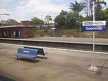
Transport
Doonside railway station is on the North Shore, Northern & Western Line of the Sydney Trains network. It provides direct links east to Blacktown, Parramatta and Sydney CBD and west to Mount Druitt and Penrith. The Great Western Highway runs along the southern border and the M4 (Sydney) is just to the south. Busways offers a number of bus services in the suburb including the 753 from Doonside station to Blacktown Interchange through the north of the suburb and the 725/726 services from Doonside to Blacktown through the south of the suburb. The 756 runs between Blacktown and Mount Druitt passing through the north of Doonside and providing connections with suburbs such as Woodcroft, Glendenning, Plumpton and Rooty Hill.[12]
Doonside Station 1880
A single line opened from Blacktown to Rooty Hill on 23 December 1861. The construction contract for the Blacktown to Kingswood section was awarded to Peto, Brassey & Betts in August 1859. The line was duplicated in 1886 and the station opened on 27 September 1880. Only a siding existed for many years. Major J. J. Walters of Bungarribee (1900-15), recalled how you would have to wave the train to stop, and similarly inform 'officials' at Blacktown station you wished to alight at Doonside (or the train would not stop).[8] The station was renamed Wolkara on 1 February 1921, and was subsequently renamed again to Doonside on 12 February 1921. The line was electrified on 9 October 1955.
The present station was upgraded in 1955, replacing the original buildings. The design of the station buildings applied the railway Stripped Functionalist style, as was done at other stations between Lidcombe and St. Mary’s. The station was one part of a much larger scheme to increase the tracks to four main lines between Lidcombe and St. Mary’s during World War II in order to provide maximum track capacity to the American ammunition and general store built at Ropes Creek. Quadruplication was completed in 1981.
A signal box was incorporated into the 1955 building but was closed in 1963 when automatic boom gates were provided at an adjacent level crossing which was itself removed in 1980. The signal box equipment has been removed.
The pedestrian bridge that provides access to the platforms was built in 1958. Its twin beam construction is typical of 1940's footbridges on the Western line quadruplication. Since 1990, every component of the bridge, except the steel structure, has been replaced.[13]
Schools
Doonside is home to two government run primary schools, Doonside Public School, near the station, and Crawford Public School, on Power Street in the north of the suburb. Not far from Crawford is Doonside Technology High, a government run high school. There are two non-government schools in Doonside. Mountain View Adventist College, on Doonside Road south of the railway line, is run by the Seventh-day Adventist Church and caters for students from Kindergarten to Year 12. St John Vianneys Primary School is a diocesan Catholic school associated with the neighbouring church, also called St John Vianney's
Doonside Public School
A 'Provisional' school was opened in 1903 but closed due to lack of support. It was reopened again in 1911 for two years. In 1937 Doonside Primary School was opened.
The first application for our school was made to Blacktown Shire Council on 28 May 1934. It was unsuccessful because Council felt that Blacktown School was big enough to accommodate students and that there was a train service from Doonside to Blacktown. In March and November 1935 it was again applied for but declined for the same reasons. But after much consideration, approval was finally given on 14 July 1936 for a public school. An area of 4 acres 3 perches had been resumed for this purpose.
The government Architect prepared plans and invited tenders (quote) for building the school. Mr S W Brown was accepted with the quote of 1,850 pounds. The building was completed and opened on 22 November 1937 with Mr Oscar Swanson as teacher.
The first weeks enrolment was 53 by the end of term there were 58.
1939 saw the number of pupils increase to 94. By 1956 there were 202 and in 1962 the number had reached 600. The numbers continued to grow due to the development of the area as new estates and housing were established.
Doonside Technology High School
The High School was opened in 1964 as Doonside High School.[14] The School became a Technology High School in 1989. [15]
Crawford Public School Opened 1977[14]
St John Vianneys Primary School Opened 1986[14]
Recreation
On the western edge of Doonside lies the Nurragingy Reserve, which is situated in the Western Sydney Regional Parklands. The Reserve is a 90ha park featuring picnic grounds and original bushland. It was established a nature reserve in 1981 and named after Nurragingy, a Darug man given a land grant in the Blacktown area in 1819.[16][17][18] Just south of the railway line is the Featherdale Wildlife Park, a private zoo established in 1953 and specialising in Australian native animals and birds.[19]
Across the railway line from Nurragingy is Kareela Reserve, a sporting complex, home to a number of local sporting teams including the Doonside Roos rugby league team,[20] Doonside Cricket Club[21] and Doonside Little Athletics.[22] The Doonside Hawks soccer club, the junior club of former Socceroos Captain Craig Moore, plays out of Glendenning Reserve in neighbouring Glendenning[23] while the Doonside Diamonds Netball Club play all their games (home and away) at the Blacktown City Netball Association complex in Blacktown.[24] All these clubs use maroon and white as their colours.
Doonside Junoir Rugby League Club.
The Rugby League Club Doonside Roos was founded in 1967 and its first committee meeting was held at the Doonside Hotel. The Colours of maroon and white and an embolem of a leaoing Kangaroo were choosing to represent the club. The first games were played in the season of 1968 at Doonside High School's oval until a permanent home ground of Kareela Reserve (Kareela East Reserve) was completed. Games were played on Bert Sanders Reserve near Feathedale Wildlife Park one year due to the amenities at Kareela being destroyed in a fire
1971 the club won its first premership.[25]
Doonside Cricket Club.
Doonside Cricket Club was established in 1975. Games are played on Kareela Reserve (Kareela East Reserve).[26]
Doonside Hawks Soccer Club.
The soccer club was founded in 1981. The clubs first home ground was to be Kareela West Reserve Doonside (today Charlie Bali Reserve) but was not completed in time for the inaugural season, so game were played at Mt Druitt Sports Centre until it was finished. Today the Clubs home ground is Glendenning Reserve of Richmond Road Glendenning.[27]
References
- 1 2 Australian Bureau of Statistics (27 June 2017). "Doonside (State Suburb)". 2016 Census QuickStats. Retrieved 15 March 2018.

- ↑ JWSM - Evolving meaning based on southern dialects, by Jim Kohen. This has now changed to "Campsite beside a creek". The only recorded meaning is "resting place of a King".
- 1 2 3 4 5 6 7 JWSM - Source research into Robert Crawford and his grant at Hill End / Doonside, and their association to Scotland, 2016-17.
- ↑ The Book of Sydney Suburbs, Compiled by Frances Pollen, Angus & Robertson Publishers, 1990, Published in Australia ISBN 0-207-14495-8
- ↑ Acms.sl.nsw.gov.au
- ↑ Blacktownaustralia.com.au
- 1 2 JWSM - Bungarribee research provided to HHT (Sydney Living Museums) in 2009.
- 1 2 JWSM - Bungarribee source document research, since 1982.
- ↑ Trove.nla.gov.au
- ↑ "Bungarribee Homestead Complex - Archaeological Site, New South Wales State Heritage Register (NSW SHR) Number H01428". New South Wales State Heritage Register. Office of Environment and Heritage. Retrieved 18 May 2018.
- ↑ "Kater, Henry Edward (1841–1924)". Australian Dictionary of Biography. Retrieved 26 December 2011.
- ↑ "Blacktown Network Map" (PDF). Busways. Archived from the original (PDF) on 22 March 2012. Retrieved 26 December 2011.
- ↑ Environment.nsw.gov.au
- 1 2 3 http://www.westernsydneylibraries.nsw.gov.au/blacktown/education.html
- ↑ "Our School – Doonside Technology High School". www.dths.com.au. Retrieved 2018-05-19.
- ↑ "Nurragingy Reserve". Blacktown City Council. Archived from the original on 24 December 2011. Retrieved 26 December 2011.
- ↑ "Nurragingy - History". Blacktown City Council. Archived from the original on 2 January 2012. Retrieved 26 December 2011.
- ↑ "Why Nurragingy?". Blacktown City Council. Archived from the original on 2 January 2012. Retrieved 26 December 2011.
- ↑ "About Featherdale". Featherdale Wildlife Park. Retrieved 26 December 2011.
- ↑ "Doonside JRLC". Doonside JRLC. Retrieved 26 December 2011.
- ↑ "Doonside Cricket Club". Westview Baptist Church. Archived from the original on 26 April 2012. Retrieved 26 December 2011.
- ↑ "About Us". Doonside Little Athletics Centre. Retrieved 26 December 2011.
- ↑ "Doonside Hawks Soccer Club". Blacktown District Soccer Football Association. Archived from the original on 3 April 2012. Retrieved 26 December 2011.
- ↑ "Doonside Diamonds". Netball Australia. Retrieved 26 December 2011.
- ↑ "History - Doonside Junior Rugby League Inc - SportsTG". SportsTG. Retrieved 2018-05-19.
- ↑ "Home - Doonside Cricket Club". Home - Doonside Cricket Club. Retrieved 2018-05-19.
- ↑ "Club History". Doonside Hawks Soccer Club. Retrieved 2018-05-19.
External links
| Wikimedia Commons has media related to Doonside, New South Wales. |
Coordinates: 33°46′10″S 150°52′00″E / 33.7694°S 150.8666°E