Doodlakine, Western Australia
| Doodlakine Western Australia | |
|---|---|
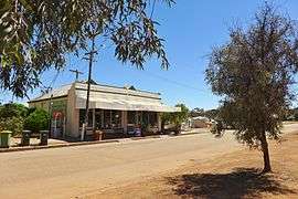 Doodlakine Store, 2014 | |
 Doodlakine | |
| Coordinates | 31°37′S 117°53′E / 31.61°S 117.88°ECoordinates: 31°37′S 117°53′E / 31.61°S 117.88°E |
| Population | 191 (2006 census)[1] |
| Established | 1891 |
| Postcode(s) | 6411 |
| Elevation | 263 m (863 ft) |
| Location |
|
| LGA(s) | Shire of Kellerberrin |
| State electorate(s) | Central Wheatbelt |
| Federal Division(s) | Durack |
Doodlakine is a town 220 km (140 mi) east of Perth, Western Australia. It is within the Shire of Kellerberrin along the Great Eastern Highway. The town contains a crossing loop for trains on the Perth-to-Kalgoorlie railway and serves as a stop on the Avonlink rural train service.
History
The area was first visited by Europeans in 1864 when explorers came and charted the area. The word Doodlakine is Aboriginal word for a particular rock formation north of the townsite.
An area close to the townsite, along the road to the Yilgarn goldfields and near a reliable water supply, was set aside in 1891 for a town to be established. This was gazetted as the Doodlakine townsite in the same year. Later a railway line was constructed through the area about 3 km (1.9 mi) south of the town, and the government soon subdivided area along the line. This area was gazetted as a second part of the townsite in 1899.[2]
In 1932 the Wheat Pool of Western Australia announced that the town would have two grain elevators, each fitted with an engine, installed at the railway siding.[3]
The town overflows with people each year during a music concert held at the pub. Hundreds of people come from around the state and camp behind the pub.[4]
Doodlakine is affectionately known by the locals as "Doodlie".[5]
Economy
The surrounding areas produce wheat and other cereal crops. The town is a receival site for Cooperative Bulk Handling.[6]
Rail services
Transwa's Avonlink and Prospector services stop at Doodlakine, at least one service each day.[7][8]
| Preceding station | Transwa Trains network | Following station | ||
|---|---|---|---|---|
towards East Perth | Avonlink East Perth – Merredin | towards Merredin |
||
towards East Perth | Prospector East Perth – Kalgoorlie | towards Kalgoorlie |
References
- ↑ Australian Bureau of Statistics (25 October 2007). "Doodlakine (State Suburb)". 2006 Census QuickStats. Retrieved 2008-09-20.
- ↑ Western Australian Land Information Authority. "History of country town names – D". Retrieved 2008-09-26.
- ↑ "Country elevators". The West Australian. Perth: National Library of Australia. 6 July 1932. p. 10. Retrieved 6 April 2013.
- ↑ "Wheatbelt Tourism – Doodlakine". 2005. Archived from the original on 22 July 2008. Retrieved 26 September 2008.
- ↑ Hough, Frank. "Inaugural Speech: Hon Frank Hough, MLC" (PDF). Parliament of Western Australia. Retrieved 13 April 2015.
- ↑ "CBH receival sites" (PDF). 2011. Archived from the original (PDF) on 18 March 2012. Retrieved 1 April 2013.
- ↑ AvonLink Timetable (PDF)
- ↑ Prospector Timetable (PDF)
External links
![]()