Donaghcloney
Donaghcloney
| |
|---|---|
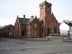 St Patrick's church | |
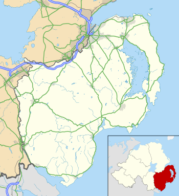 Donaghcloney shown within County Down | |
| Population | 1,701 (2011 Census) |
| Irish grid reference | J129537 |
| • Belfast | 23 mi (37 km) |
| District | |
| County | |
| Country | Northern Ireland |
| Sovereign state | United Kingdom |
| Post town | CRAIGAVON |
| Postcode district | BT66 |
| Dialling code | 028, +44 28 |
| EU Parliament | Northern Ireland |
| UK Parliament | |
| NI Assembly | |
Donaghcloney or Donacloney (from Irish: Domhnach Cluana, meaning "church of the meadow")[1][2] is a small village, townland (of 300 acres) and civil parish in County Down,[1][2][3] Northern Ireland. It lies on the River Lagan between Lurgan and Dromore. In the 2011 Census it had a population of 1701.
Linen industry
Donaghcloney is a typical Ulster village linked to the Irish linen industry since 1742. The most recent Ewart Liddell company was formed in 1973 by a merger between William Ewart and Sons which started business in Belfast in 1814 and William Liddell and Company which started in Donaghcloney in 1866.[4] Their factory was the biggest Irish linen, Jacquard weaving company in Ireland, and made the linen for the RMS Titanic.[5]
Sport
The village has a history of cricket playing over many generations with the Donaghcloney Cricket Club.
Donacloney Football Club have two men's teams both playing in the Mid-Ulster Football League The club's home pitch is in the village alongside the River Lagan.
Education
- Donaghcloney Primary School
Transport
Donaghcloney is served by the Ulsterbus route 56, linking the village with Lurgan and Banbridge. There are relatively good roads to many towns nearby, such as Dromore, Moira and Lisburn. The nearest railway station is located five miles away in Moira. Until 1956, the nearest station was Mullafernaghan on the Great Northern Railway (Ireland) line from Knockmore to Newcastle.
2001 Census
Donaghcloney is classified as a small village by the Northern Ireland Statistics and Research Agency (NISRA) (i.e. with population between 500 and 1,000 people). On Census day (29 April 2001) there were 972 people living in Donaghcloney. Of these:
- 21.8% were aged under 16 years and 21.9% were aged 60 and over,
- 48.6% of the population were male and 51.4% were female,
- 4.0% were from a Catholic background and 93.5% were from a Protestant background,
- 2.5% of people aged 16–74 were unemployed.
People
- Loyalist Robin "the Jackal" Jackson, former leader of the Ulster Volunteer Force's (UVF) Mid-Ulster Brigade, was a notable resident of Donaghcloney up until his death of lung cancer at the age of 52 on 30 May 1998.
- Bernard McQuirt, recipient of the Victoria Cross
Civil parish of Donaghcloney
The civil parish is situated in the historic barony of Iveagh Lower, Upper Half and contains the following settlements:[6]
- Donaghcloney
- Waringstown
Townlands
The civil parish contains the following townlands:[6]
- Annaghanoon
- Annaghmakeonan
- Ballygunaghan
- Ballynabragget
- Banoge
- Corcreeny
- Cornreany
- Donaghcloney
- Lurgantamry
- Magherana
- Monree
- Moygannon
- Tullycarn
- Tullyherron
References
- 1 2 Placenames NI Archived June 2, 2012, at the Wayback Machine.
- 1 2 Placenames Database of Ireland
- ↑ Online map viewer, Ordnance Survey Ireland.
- ↑ http://www.liddell-international.com/about-us/
- ↑ http://www.liddell-international.com/heritage/
- 1 2 "Donaghcloney". IreAtlas Townlands Database. Retrieved 18 May 2015.
