Dolakha Town, Nepal
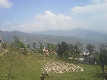
Dolakha Town is a Municipality of the Dolakha District, located in the Janakpur Zone and the lower Himalayas region of northern Nepal.
The municipality is also within the Central Development Region of Nepal.
Etymology
In its origin the town of Dolakha was called "Abhayapur" which means "Abhay" — without fear; and "pur" — cities. That is why Dolakha Town is also referred to as the "city without fear" because of the power of the god Bhim Sen.
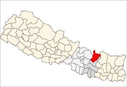
Dolakha District
The total land area of the Dolakha District, which Dolakha Town is part of, is about 2,191 km2.
Its borders contiguous with Solukhumbu District and Ramechhap District in the east; Ramechhap and Sindhupalchok District in the south, Sindhupalchowk District in the west; and with the Tibet and the Tibetan Autonomous Region of People's Republic of China in the north.
Sitali, the lowest part of Dolakha District is 723 metres (2,372 ft) above sea level whereas Mt. Gaurishankar, the highest part of the district is 7,134 metres (23,406 ft) above sea level.
Village Development Committees (VDCs)
Former Village development committees (VDCs) in the Dolakha District, replaced in 2017 by Gaunpalikas (rural municipalities), were:
- Alampu
- Babare
- Bhedapu
- Bhimeshwar Municipality
- Bhirkot
- Bhusafeda
- Bigu
- Bocha
- Bulung
- Chankhu
- Charikot
- Chhetrapa
- Chilankha
- Chyama
- Dadhpokhari
- Dandakharka
- Fasku
- Gairimudi
- Gauri Sankar
- Ghyang Sukathokar
- Hawa
- Japhe
- Jhule
- Jhyaku
- Jiri
- Jugu
- Kabhre
- Kabum
- Katakuti
- Khare
- Khupachagu
- Laduk
- Lakuri Danda
- Lamabagar
- Lamidada
- Lapilang
- Magapauwa
- Makaibari
- Mali
- Malu
- Marbum
- Mati
- Melung
- Dandakharka
- Kaulay
- Mirge
- Namdu
- Orang
- Pawati
- Sahare
- Sailungeswor
- Sunakhani
- Sundrawati
- Sureti
- Susma Chhemawati
- Syama
- Thulopatal
See also
- Dolakha District topics
- Rural municipalities of Nepal