Gaurishankar, Dolakha
| Gaurishankar गौरीशंकर | |
|---|---|
| Rural municipality | |
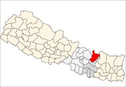
 Gaurishankar Location in Nepal | |
| Coordinates: 27°53′N 86°24′E / 27.88°N 86.40°ECoordinates: 27°53′N 86°24′E / 27.88°N 86.40°E | |
| Country |
|
| Zone | Janakpur Zone |
| District | Dolakha District |
| Population (1991) | |
| • Total | 1,392 |
| Time zone | UTC+5:45 (Nepal Time) |
Gaurishankar is currently referred to as Ward No. 9 under Gaurishankar Rural Municipality in Province No. 3, Dolakha District of Nepal. At the time of the 1991 Nepal census it had a population of 1392 people living in 291 individual households.[1]
References
- ↑ "Nepal Census 2001", Nepal's Village Development Committees, Digital Himalaya, archived from the original on 12 October 2008, retrieved 15 November 2009 .
External links
This article is issued from
Wikipedia.
The text is licensed under Creative Commons - Attribution - Sharealike.
Additional terms may apply for the media files.