Dogger Bank

Dogger Bank (Dutch: Doggersbank, German: Doggerbank, Danish: Doggerbanke) is a large sandbank in a shallow area of the North Sea about 100 kilometres (62 mi) off the east coast of England.
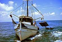
During the last ice age the bank was part of a large landmass connecting Europe and the British Isles, now known as Doggerland. It has long been known by fishermen to be a productive fishing bank; it was named after the doggers, medieval Dutch fishing boats especially used for catching cod.
At the beginning of the 21st century the area was identified as a potential site for a UK round 3 wind farm, being developed as Dogger Bank Wind Farm.[1]
Geography
The bank extends over about 17,600 square kilometres (6,800 sq mi), and is about 260 km long by 97 km broad (160 by 60 mi).[2] The water depth ranges from 15 to 36 metres (49 to 118 ft), about 20 metres (66 ft) shallower than the surrounding sea.
The bank is an important fishing area, with cod and herring being caught in large numbers. It gives its name to the Dogger sea area used in the BBC Radio 4 Shipping Forecast. Several shipwrecks lie on the bank.
Dogger Bank has been identified as an oceanic environment that exhibits high primary productivity throughout the year in the form of phytoplankton. As such, it has been proposed by various groups to designate the area a Marine Nature Reserve.[3]
Geology
Geologically, the feature is most likely a moraine, formed during the Pleistocene.[2] At differing times during the last glacial period it was either joined to the mainland or an island. The bank was part of a large landmass, now known as Doggerland, which connected Britain to the European mainland until it was flooded some time after the end of the last glacial period.[4]
Fishing trawlers working the area have dredged up large amounts of moor peat, remains of mammoth and rhinoceros, and occasionally Paleolithic hunting artefacts.[5]
The 1931 Dogger Bank earthquake took place below the bank, measuring 6.1 on the Richter scale and was the largest earthquake ever recorded in the United Kingdom. Its hypocentre was 23 kilometres (14 mi) beneath the bank, and the quake was felt in countries all around the North Sea, causing damage across eastern England.
South of Dogger Bank is the Cleaver Bank.
Naval battles and incidents
- Battle of Dogger Bank (1696), during the Nine Years' War a French fleet under the command of Jean Bart was victorious over the ships of a Dutch force of five ships and the convoy it was escorting.
- Battle of Dogger Bank (1781), during the Fourth Anglo-Dutch War, a Royal Navy squadron fought a Dutch squadron on 5 August 1781.
- Dogger Bank incident, during the Russo-Japanese War, Russian naval ships opened fire on British fishing boats in the on 21 October 1904, mistaking them for Japanese torpedo boats.
- Battle of Dogger Bank (1915) and Battle of Dogger Bank (1916), during the First World War, saw battles between the Royal Navy and the German High Seas Fleet.
- In 1966, the German submarine U-Hai, a German Type XXIII submarine sank during a gale. 19 of 20 men died, one of the worst peacetime naval disasters in German history.
Wind farm and wind power hub
The Dogger Bank is an attractive location for offshore wind farms because it is far away from shore, avoiding complaints about the visual impact of wind turbines, yet the water is shallow enough for traditional fixed foundation wind turbine designs.[6] Fixed-foundation wind turbines are economically limited to maximum water depths of 40m to 50m,[7] at greater water depths new floating wind turbine designs are required, which currently cost significantly more to build.[8]
In January 2010, a licence to develop a wind farm on Dogger Bank was granted to Forewind Ltd, a consortium of developers. Originally projected to develop up to 9 gigawatts of power as part of a planned nine zone project of 32 gigawatts, the plan was later scaled down to a 7.2-gigawatt installation in agreement with the area's owner Crown Estates.[9]
Construction was scheduled to start around 2014 at the earliest, but has been repeatedly postponed.[10]
Dutch, German, and Danish electrical grid operators are cooperating in a project to build a North Sea Wind Power Hub complex on one or more artificial islands to be constructed on Dogger Bank as part of a European system for sustainable electricity. At the North Seas Energy Forum in Brussels on 23 March 2017, Energinet.dk will sign a contract to work with the German and Dutch branches of TenneT; thereafter a feasibility study will be produced.[11][12]
See also
- Dogger, the name of one of the sea regions of the British Shipping Forecast
- Dogger Bank itch, a dermatological condition common in North Sea fishmen
- North Sea Wind Power Hub
- Fishing in the North Sea
- Other places under the North Sea: Broad Fourteens, Devil's Hole (North Sea), Fisher Bank, Fladen Ground, Long Forties, Silver Pit, Outer Silver Pit
- Doggerland
References
- ↑ "Danish, Dutch and German firms to build huge artificial island for wind power". 10 March 2017.
- 1 2 Stride, A.H (January 1959). "On the origin of the Dogger Bank, in the North Sea". Geological Magazine. 96 (1): 33–34. doi:10.1017/s0016756800059197.
- ↑ "The Dogger Bank – A Potential MPA" (PDF). WWF. Archived from the original (PDF) on 2007-01-28. Retrieved 15 Oct 2008.
- ↑ Spinney, Laura (25 Apr 2013). "Searching for Doggerland – National Geographic Magazine". Ngm.nationalgeographic.com.
- ↑ Duff, Joel (24 Feb 2014). "Fishing for Fossils in the North Sea: The Lost World of Doggerland – Naturalis Historia". Thenaturalhistorian.com.
- ↑ Harvey, Fiona (17 Feb 2015). "World's biggest offshore windfarm approved for Yorkshire coast". The Guardian.
- ↑ "Deep Water - The next step for offshore wind energy". WindEurope.org. European Wind Energy Association. Retrieved 26 July 2017.
- ↑ Martin, Richard. "Floating Wind Farms: Great Concept, Implausible Economics". MIT Technology Review. MIT Technology Review. Retrieved 26 July 2017.
- ↑ Laister, David (19 Feb 2014). "Dogger Bank wind farm zone to be scaled back by 20 per cent". Grimsby Telegraph. Archived from the original on 2014-05-02.
- ↑ "New UK offshore wind farm licences are announced". news.bbc.co.uk. January 8, 2010.
- ↑ "Artificial island is planned on Dogger Bank for cheaper wind power". Sky News. 13 March 2017.
- ↑ "First meeting of North Seas Energy Forum". European Commission. Retrieved 23 March 2017.
External links
![]()
Fishing industry by region | ||
|---|---|---|
| By country |  | |
| Fishing banks | ||
| By species | ||
| Other areas | ||