Dodge, Washington
| Dodge, Washington | |
|---|---|
| Unincorporated community | |
 Dodge  Dodge | |
| Coordinates: 46°31′29″N 117°49′18″W / 46.52472°N 117.82167°WCoordinates: 46°31′29″N 117°49′18″W / 46.52472°N 117.82167°W | |
| Country | United States |
| State | Washington |
| County | Garfield |
| Elevation[1] | 1,273 ft (388 m) |
| Time zone | UTC-8 (Pacific (PST)) |
| • Summer (DST) | UTC-7 (PDT) |
| ZIP code | 99347 |
| Area code(s) | 509 |
| GNIS feature ID | 1530858 |
Dodge is an unincorporated community in Garfield County, in the Palouse region of southeastern Washington. It is located at the junction of U.S. Route 12 and State Route 127, northwest of Pomeroy.[2]
References
- ↑ "US Board on Geographic Names". United States Geological Survey. October 25, 2007. Retrieved August 23, 2018.
- ↑ "Dodge, Washington". Geographic Names Information System. United States Geological Survey. Retrieved August 23, 2018.
Municipalities and communities of Garfield County, Washington, United States | ||
|---|---|---|
| City | 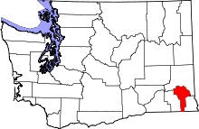 | |
| Unincorporated communities | ||
| Ghost town | ||
This article is issued from
Wikipedia.
The text is licensed under Creative Commons - Attribution - Sharealike.
Additional terms may apply for the media files.