Diamond Beach, New Jersey
| Diamond Beach, New Jersey | |
|---|---|
| Census-designated place | |
 Diamond Beach in 2015 | |
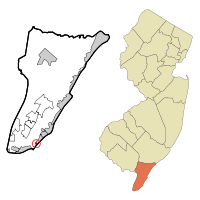 Map of Diamond Beach CDP in Cape May County | |
| Coordinates: 38°57′32″N 74°51′07″W / 38.958852°N 74.852009°WCoordinates: 38°57′32″N 74°51′07″W / 38.958852°N 74.852009°W | |
| Country |
|
| State |
|
| County | Cape May |
| Township | Lower |
| Area[1] | |
| • Total | 0.157 sq mi (0.406 km2) |
| • Land | 0.157 sq mi (0.406 km2) |
| • Water | 0.000 sq mi (0.000 km2) 0.00% |
| Elevation[2] | 7 ft (2 m) |
| Population (2010 Census)[3] | |
| • Total | 136 |
| • Density | 868.4/sq mi (335.3/km2) |
| Time zone | UTC-5 (Eastern (EST)) |
| • Summer (DST) | UTC-4 (Eastern (EDT)) |
| Area code(s) | 609 |
| FIPS code | 3417815[4] |
| GNIS feature ID | 02389406[5] |
Diamond Beach is an unincorporated community and census-designated place (CDP) located within Lower Township in Cape May County, New Jersey, United States.[6] It is part of the Ocean City Metropolitan Statistical Area. As of the United States 2010 Census, the CDP's population was 136.[3]
Geography
According to the United States Census Bureau, Diamond Beach had a total area of 0.157 square miles (0.406 km2), all of which was land.[1][7]
Diamond Beach is home to many upscale townhouses and Seapointe Village, site of a police substation that opened in 2013.[8]
Demographics
| Historical population | |||
|---|---|---|---|
| Census | Pop. | %± | |
| 2000 | 218 | — | |
| 2010 | 136 | −37.6% | |
| Population sources: 2000[9] 2010[3] | |||
Census 2010
As of the 2010 United States Census, there were 136 people, 71 households, and 46.01 families residing in the CDP. The population density was 868.4 per square mile (335.3/km2). There were 845 housing units at an average density of 5,395.7 per square mile (2,083.3/km2). The racial makeup of the CDP was 100.00% (136) White, 0.00% (0) Black or African American, 0.00% (0) Native American, 0.00% (0) Asian, 0.00% (0) Pacific Islander, 0.00% (0) from other races, and 0.00% (0) from two or more races. Hispanic or Latino of any race were 0.00% (0) of the population.[3]
There were 71 households out of which 9.9% had children under the age of 18 living with them, 57.7% were married couples living together, 2.8% had a female householder with no husband present, and 35.2% were non-families. 31.0% of all households were made up of individuals, and 8.5% had someone living alone who was 65 years of age or older. The average household size was 1.92 and the average family size was 2.28.[3]
In the CDP, the population was spread out with 6.6% under the age of 18, 2.2% from 18 to 24, 11.8% from 25 to 44, 42.6% from 45 to 64, and 36.8% who were 65 years of age or older. The median age was 60.4 years. For every 100 females there were 94.3 males. For every 100 females ages 18 and older there were 86.8 males.[3]
Census 2000
As of the 2000 United States Census[4] there were 218 people, 103 households, and 73 families residing in the place. The population density was 526.1/km² (1,404.7/mi²). There were 1,017 housing units at an average density of 2,454.2/km² (6,553.3/mi²). The racial makeup of the CDP was 96.33% White, 2.29% African American, 0.92% Asian, and 0.46% from two or more races. Hispanic or Latino of any race were 1.38% of the population.[9]
There were 103 households out of which 16.5% had children under the age of 18 living with them, 60.2% were married couples living together, 7.8% had a female householder with no husband present, and 29.1% were non-families. 24.3% of all households were made up of individuals and 10.7% had someone living alone who was 65 years of age or older. The average household size was 2.12 and the average family size was 2.47.[9]
In the place the population was spread out with 12.4% under the age of 18, 5.0% from 18 to 24, 17.4% from 25 to 44, 39.4% from 45 to 64, and 25.7% who were 65 years of age or older. The median age was 52 years. For every 100 females, there were 100.0 males. For every 100 females age 18 and over, there were 91.0 males.[9]
The median income for a household in the place was $83,787, and the median income for a family was $83,735. Males had a median income of over $100,000 versus $0 for females. The per capita income for the CDP was $54,883. None of the population or families were below the poverty line.[9]
Climate
During the summer months, frequent episodes of high humidity occur. Occasionally, heat index values exceed 95 °F (35 °C). During most summer afternoons, a sea breeze dominates the coastline keeping high temperatures several degrees cooler compared to areas farther inland. During most nights, relatively mild ocean waters keep the coastline several degrees warmer than areas farther inland. On average, July is the annual peak for thunderstorm activity. During the winter months, wind chill values occasionally fall below 0 °F (-18 °C). On average, the snowiest month of the year is February which corresponds with the annual peak for nor'easter activity.
| Climate data for Diamond Beach, New Jersey (1981 – 2010 averages). | |||||||||||||
|---|---|---|---|---|---|---|---|---|---|---|---|---|---|
| Month | Jan | Feb | Mar | Apr | May | Jun | Jul | Aug | Sep | Oct | Nov | Dec | Year |
| Average high °F (°C) | 41.9 (5.5) |
43.6 (6.4) |
50.3 (10.2) |
59.3 (15.2) |
68.6 (20.3) |
77.7 (25.4) |
82.8 (28.2) |
81.5 (27.5) |
76.1 (24.5) |
66.2 (19) |
56.2 (13.4) |
46.7 (8.2) |
62.6 (17) |
| Average low °F (°C) | 28.2 (−2.1) |
29.9 (−1.2) |
36.0 (2.2) |
45.0 (7.2) |
53.9 (12.2) |
63.7 (17.6) |
68.9 (20.5) |
68.2 (20.1) |
61.8 (16.6) |
50.6 (10.3) |
41.6 (5.3) |
32.7 (0.4) |
48.4 (9.1) |
| Average precipitation inches (mm) | 3.36 (85.3) |
2.81 (71.4) |
4.16 (105.7) |
3.64 (92.5) |
3.60 (91.4) |
3.19 (81) |
3.79 (96.3) |
4.09 (103.9) |
3.27 (83.1) |
3.61 (91.7) |
3.24 (82.3) |
3.62 (91.9) |
42.38 (1,076.5) |
| Average snowfall inches (cm) | 4.2 (10.7) |
6.3 (16) |
1.6 (4.1) |
0.2 (0.5) |
0.0 (0) |
0.0 (0) |
0.0 (0) |
0.0 (0) |
0.0 (0) |
0.0 (0) |
0.2 (0.5) |
2.4 (6.1) |
14.9 (37.8) |
| Source: PRISM [10] | |||||||||||||
| Climate data for Atlantic City, New Jersey (Ocean Water Temperature). | |||||||||||||
|---|---|---|---|---|---|---|---|---|---|---|---|---|---|
| Month | Jan | Feb | Mar | Apr | May | Jun | Jul | Aug | Sep | Oct | Nov | Dec | Year |
| Daily mean °F (°C) | 37 (3) |
35 (2) |
42 (6) |
48 (9) |
56 (13) |
63 (17) |
70 (21) |
73 (23) |
70 (21) |
61 (16) |
53 (12) |
44 (7) |
54 (12) |
| Source: NOAA [11] | |||||||||||||
Education
As with other parts of Lower Township, it is served by Lower Township School District for primary grades and Lower Cape May Regional School District for secondary grades; the latter operates Lower Cape May Regional High School.
References
- 1 2 Gazetteer of New Jersey Places, United States Census Bureau. Accessed July 21, 2016.
- ↑ U.S. Geological Survey Geographic Names Information System: Diamond Beach Census Designated Place, Geographic Names Information System. Accessed October 18, 2012.
- 1 2 3 4 5 6 DP-1 - Profile of General Population and Housing Characteristics: 2010 Demographic Profile Data for Diamond Beach CDP, New Jersey, United States Census Bureau. Accessed October 18, 2012.
- 1 2 American FactFinder, United States Census Bureau. Accessed September 4, 2014.
- ↑ US Board on Geographic Names, United States Geological Survey. Accessed September 4, 2014.
- ↑ New Jersey: 2010 - Population and Housing Unit Counts - 2010 Census of Population and Housing (CPH-2-32), United States Census Bureau, August 2012. Accessed October 18, 2012.
- ↑ US Gazetteer files: 2010, 2000, and 1990, United States Census Bureau. Accessed September 4, 2014.
- ↑ Staff. "Lower Township Police Open New Diamond Beach Substation", Cape May County Herald, July 1, 2013. Accessed July 9, 2014. "Lower Township police have opened a substation in Diamond Beach at a new location in Seapointe Village."
- 1 2 3 4 5 DP-1 - Profile of General Demographic Characteristics: 2000 from the Census 2000 Summary File 1 (SF 1) 100-Percent Data for Diamond Beach CDP, New Jersey, United States Census Bureau. Accessed October 18, 2012.
- ↑
- ↑
External links
| Wikimedia Commons has media related to Diamond Beach, New Jersey. |
- The Wildwood Leader
- Campbell, Al (July 7, 2007). "Nine Injured in Crab House Floor Collapse". Cape May County Herald.
- The Cape May Gazette
| Preceded by Wildwood Crest |
Beaches of New Jersey | Succeeded by Cape May |
Municipalities and communities of Cape May County, New Jersey, United States | ||
|---|---|---|
| Cities | 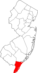 | |
| Boroughs | ||
| Townships | ||
| CDPs | ||
| Other unincorporated communities | ||