Diakopto
| Diakopto Διακοπτό | |
|---|---|
.jpg) Diakopto train station in 1992 (metric gauge line not in use any more) | |
 Diakopto Location within the regional unit 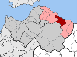 | |
| Coordinates: 38°11′N 22°11′E / 38.183°N 22.183°ECoordinates: 38°11′N 22°11′E / 38.183°N 22.183°E | |
| Country | Greece |
| Administrative region | West Greece |
| Regional unit | Achaea |
| Municipality | Aigialeia |
| Districts | 12 |
| • Municipal unit | 103.93 km2 (40.13 sq mi) |
| Elevation | 52 m (171 ft) |
| Population (2011)[1] | |
| • Municipal unit | 6,429 |
| • Municipal unit density | 62/km2 (160/sq mi) |
| Community[1] | |
| • Population | 2,252 (2011) |
| Time zone | UTC+2 (EET) |
| • Summer (DST) | UTC+3 (EEST) |
| Postal code | 250 03 |
| Area code(s) | 24230 |
| Vehicle registration | BO |
| Website | www.diakopto.gov.gr |
Diakopto (Greek: Διακοπτό) is a town and a former municipality in Achaea, West Greece, Greece. Since the 2011 local government reforms it is a municipal unit of the Aigialeia municipality.[2] The municipal unit has an area of 103.932 km2.[3] Population 6,429 (2011). The town of Diakopto is situated on the Gulf of Corinth, near the mouth of the Vouraikos river and at the lower end of the Vouraikos Gorge. The 750 mm (2 ft 5 1⁄2 in) gauge Diakofto–Kalavryta Railway built in 1885 leads up to the town of Kalavryta passing the Mega Spilaio Monastery at about halfway. Diakopto is on the old Greek National Road 8 (Athens - Corinth - Patras); the new Greek National Road 8A (also Athens - Corinth - Patras) passes 1 km to the south. Diakopto is located about 40 km east of Patras, and 15km southeast of Aigio.
Subdivisions
The municipal unit Diakopto is subdivided into the following communities (constituent villages in brackets):
- Ano Diakopto (Ano Diakopto, Pounta)
- Diakopto (Diakopto, Kalyvitis, Kernitsa, Lofos)
- Eliki (Eliki, Kalanteri)
- Katholiko
- Keryneia (Keryneia, Nea Keryneia)
- Mamousia (Mamousia, Derveni, Stavria)
- Nikoleika
- Rizomylos
- Rodia
- Trapeza (Trapeza, Paralia Trapezis)
- Tripia (Tripia, Metochi, Terpsithea)
- Zachloritika
Population
| Year | Municipality population | Village population |
|---|---|---|
| 1981 | - | 1,848 |
| 1991 | 7,023 | 2,109 |
| 2001 | 7,005 | 2,290 |
| 2011 | 6,429 | 2,183 |
History
In the area there were three ancient Greek cities: Boura, Helike and Keryneia. The area followed the fate of the rest of Achaea. Between 1460 and 1821 the area was ruled by the Ottoman Empire, except a brief period of Venetian rule between 1687 and 1715. As a result of the Greek War of Independence of 1821 Diakopto became part of the new Greek state. The municipality was created in 1835. The municipality was known as Voura (Βουρά).
Persons
- Dionysis Papagiannopoulos (1912–1984) actor
Sporting clubs
- Lykoi Diakoptou
- Floga Rodias
- Iraklis Zachloritikon
- Niki Nikoleikon
- Athlitikos Omilos Diakoptou (AOD)
See also
References
- 1 2 "Απογραφή Πληθυσμού - Κατοικιών 2011. ΜΟΝΙΜΟΣ Πληθυσμός" (in Greek). Hellenic Statistical Authority.
- ↑ Kallikratis law Greece Ministry of Interior (in Greek)
- ↑ "Population & housing census 2001 (incl. area and average elevation)" (PDF) (in Greek). National Statistical Service of Greece. Archived from the original (PDF) on 2015-09-21.