Myrovrysi
| Myrovrysi Μυρόβρυση | |
|---|---|
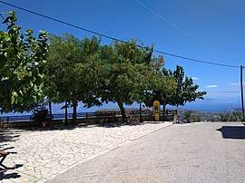 The small square in the centre of the village | |
 Myrovrysi | |
| Coordinates: 38°14′N 21°57′E / 38.233°N 21.950°ECoordinates: 38°14′N 21°57′E / 38.233°N 21.950°E | |
| Country | Greece |
| Administrative region | West Greece |
| Regional unit | Achaea |
| Municipality | Aigialeia |
| Municipal unit | Sympoliteia |
| Highest elevation | 600 m (2,000 ft) |
| Population (2011)[1] | |
| • Rural | 211 |
| Time zone | UTC+2 (EET) |
| • Summer (DST) | UTC+3 (EEST) |
| Vehicle registration | ΑΧ,ΑΖ |
Myrovrysi (Greek: Μυρόβρυση)[2] is a mountain village in the municipal unit of Sympoliteia, Achaea, Greece. It is located in the eastern foothills of the Panachaiko, 11 km south of Selianitika and 44.3 Km east of Patras. In 2011, it had a population of 211.[3]
References
- ↑ "Απογραφή Πληθυσμού - Κατοικιών 2011. ΜΟΝΙΜΟΣ Πληθυσμός" (in Greek). Hellenic Statistical Authority.
- ↑ Myrovrysi at the GDP Travel Pages
- ↑ 2011 population census in Greece
This article is issued from
Wikipedia.
The text is licensed under Creative Commons - Attribution - Sharealike.
Additional terms may apply for the media files.