Delvinaki
| Delvinaki Δελβινάκι | |
|---|---|
 Delvinaki Location within the regional unit 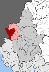 | |
| Coordinates: 39°56′N 20°28′E / 39.933°N 20.467°ECoordinates: 39°56′N 20°28′E / 39.933°N 20.467°E | |
| Country | Greece |
| Administrative region | Epirus |
| Regional unit | Ioannina |
| Municipality | Pogoni |
| Districts | 17 |
| • Municipal unit | 255.835 km2 (98.778 sq mi) |
| Population (2011)[1] | |
| • Municipal unit | 2,540 |
| • Municipal unit density | 9.9/km2 (26/sq mi) |
| Community[1] | |
| • Population | 772 (2011) |
| • Area (km2) | 54.824 |
| Time zone | UTC+2 (EET) |
| • Summer (DST) | UTC+3 (EEST) |
| Postal code | 440 04 |
| Vehicle registration | IN |
Delvinaki (Greek: Δελβινάκι) is a former municipality in the Ioannina regional unit, Epirus, Greece. Since the 2011 local government reform it is part of the municipality Pogoni, of which it is a municipal unit.[2] The municipal unit has an area of 255.835 km2, the community 54.824 km2.[3] In 2011 its population was 772 for the village and 2,540 for the municipal unit. Delvinaki is part of the traditional area Pogoni.
Delvinaki is situated on the road GR-22/E853 which links Kalpaki with the Albanian border. The border crossing Kakavia is west of town.
Subdivisions
The municipal unit Delvinaki is subdivided into the following communities (constituent villages in brackets):
Population
| Year | Village population | Municipal unit population |
|---|---|---|
| 1981 | 884 | - |
| 1991 | 922 | - |
| 2001 | 751 | 2,933 |
| 2011 | 772 | 2,540 |
History
During the first decades of the 14th century, Albanians settled in the Pogoni region and their presence is evidenced through some place names derived from the Albanian language such as Delvinaki (place of vineyards), Gouvari (from gouva = hollow), Roumbates (robe, garment) and so on. [4][5] In the late 17th century, Ottoman traveler Evliya Çelebi passed through Delvinaki observing that it was "prosperous" and in Pogoni, "inhabited by infidels all Albanians" containing 400 houses, 6000 fertile vineyards, 40-50 shops, 10 churches and 3 inns.[6] Çelebi also noted that Delvinaki was a hass (revenue estate) of an Ottoman admiral and administered by a voivode with the settlement being "exempt from taxation and state interference."[6] Those Albanian villagers who settled in the southern part of Pogoni were gradually assimilated by the Greek element.[4]
Delvinaki joined Greece after the Balkan Wars of 1913.
Notable people
- Petroloukas Chalkias, musician.
- Hatzimichalis Dalianis, hero of the Greek War of Independence.
- Evangelos Psimmas, (1905–1962), bishop of Ermoupoli.
- Konstantinos Iroklis Vasiadis, (1821–1890), scholar.
See also
References
- 1 2 "Απογραφή Πληθυσμού - Κατοικιών 2011. ΜΟΝΙΜΟΣ Πληθυσμός" (in Greek). Hellenic Statistical Authority.
- ↑ Kallikratis law Greece Ministry of Interior (in Greek)
- ↑ "Population & housing census 2001 (incl. area and average elevation)" (PDF) (in Greek). National Statistical Service of Greece. Archived from the original (PDF) on 2015-09-21.
- 1 2 Vakalopoulos, Kōnstantinos Apostolou (2003). Historia tēs Ēpeirou: apo tis arches tēs Othōmanokratias hōs tis meres mas. Hērodotos. p. 322. ISBN 9607290976. "Κατά τις πρώτες δεκαετίες του 14ου αιώνα τοποθετείται χρονικά η αλβανική διείσδυση στο χώρο της Πωγωνιανής, που μαρτυρείται και από ορισμένα τοπωνύμια όπως το Δελβινάκι (αμπελότοπος), το Γκουβέρι (γκούβα = κοίλωμα), αλλά και από τις μετακινήσείς αλβανικόν οικογενειών, οι οποίες εξισλαμήστικαν λόγω των σινθηκών που επικρατούσαν. Όσοι αλβανικοί πλιθυσμοί είηαν εγκατασταθεί στο νότιο τμήμα του Πωγωνίου, αφομοιώθηκαν βαθμιαία από το ελλινικό στοιχείο και εξελληνίστικαν. Όλες οι κοινότητες...."
- ↑ Ifantis, Nikos Th. (2005). Η Πωγωνιανή - Παλιά Βοστίνα και τα Κοινοτικά Διαμερίσματα Δολό-Δρυμάδες-Σταυροσκιάδι. Διευρυμένη Κοινότητα Πωγωνιανής. p. 45. "όπως και από αλβανικές ονομασίες χωριών: Ρομπάτες (= ρόμπα, ένδυμα), Δελβινακίων (= αμπελότοπος), Γούβερη (Γούβα - Κοίλωμα) κ.λ.π."
- 1 2 Dankoff, Robert; Elsie, Robert (2000). Evliya Çelebi in Albania and Adjacent Regions: Kossovo, Montenegro, Ohrid. Brill. p. 91. ISBN 9789004116245. "We returned by another road, passing through prosperous villages. After 4 hours of travelling westwards, we arrived at Delvinaki. It is a prosperous town on the border of the district of Pogonia and consists of 400 houses inhabited by infidels all Albanians and 6000 fertile vineyards. It has 40 to 50 shops, 10 churches and 3 hans. This town is a has belonging to the admiral of the Ottoman fleet and administered by a voyvoda. It is exempt from taxation and state interference."
External links
Places adjacent to Delvinaki | ||||||||||
|---|---|---|---|---|---|---|---|---|---|---|
| ||||||||||