Deliverance, Kansas
| Deliverance, Kansas | |
|---|---|
| Coordinates: 39°20′10″N 99°01′06″W / 39.33611°N 99.01833°WCoordinates: 39°20′10″N 99°01′06″W / 39.33611°N 99.01833°W [1] | |
| Country | United States |
| State | Kansas |
| County | Osborne |
| Elevation | 1,939 ft (591 m) |
| Time zone | UTC-6 (Central (CST)) |
| • Summer (DST) | UTC-5 (CDT) |


Deliverance (initially Pleasant Plain) was a small settlement in Mt Ayr Township, Osborne County, Kansas, United States.
History
Pleasant Plain was located near the head of Little Medicine Creek.[2] Pleasant Plain was issued a post office in 1878. The post office name was changed to Deliverance in 1894, then discontinued in 1904. There is nothing left of Deliverance.[3] The population in 1910 was 20.[2]
References
- ↑ "Topo Map". TopoZone. Retrieved 2017-12-30.
- 1 2 Blackmar, Frank Wilson (1912). Kansas: A Cyclopedia of State History, Volume 1. Chicago: Standard Publishing Company. p. 507.
- ↑ "Kansas Post Offices, 1828-1961". Kansas Historical Society. Retrieved 2017-12-30.
Municipalities and communities of Osborne County, Kansas, United States | ||
|---|---|---|
| Cities | 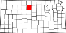 | |
| Unincorporated communities | ||
| Ghost towns | ||
| Townships |
| |
This article is issued from
Wikipedia.
The text is licensed under Creative Commons - Attribution - Sharealike.
Additional terms may apply for the media files.