Deepdale, Preston
| Deepdale | |
|---|---|
 Location in the City of Preston district | |
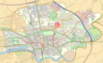 Deepdale Location in Preston  Deepdale Deepdale shown within Lancashire | |
| Population | 6,103 (2011) |
| District | |
| Ceremonial county | |
| Region | |
| Country | England |
| Sovereign state | United Kingdom |
| EU Parliament | North West England |
| UK Parliament | |
| Councillors |
|
Deepdale is an electoral ward in Preston, Lancashire, England. The population of the ward as taken at the 2011 census was 6,103.[1] The ward is home to the Deepdale football stadium of Preston North End. The ward is a predominantly urban area of terraced housing, notable for one of the largest South Asian populations in the city.
Deepdale borders Moor Park, and has a number of mosques and one of two branches of Domino's Pizza in Preston. The former Deepdale railway station was to be found in this ward.
Two members of Preston City Council, elected 'in thirds' in first past the post elections each year, are returned from the ward.
The ward forms part of the Lancashire County Council electoral division of Preston Central North.
Current members
| Election | Member | Party | |
|---|---|---|---|
| Preston Council election, 2007 | Joyce Cartwright | Independent | |
| Preston Council election, 2008 | Terry Cartwright | Independent | |
Demographics
From the 2001 census,[2] Deepdale ward had a population of 5,802. Of this figure, 44% described themselves as Muslim, and 38% as Christian.
In 2011, Deepdale had a population of 6103 people. Here is an ethnic breakdown of the ward.[3]
| Deepdale 2011 Statistics | Percentage | Amount Compared to total population of 6103 |
|---|---|---|
| White British | 32.4% | 1983 |
| White Other | 4.3% | 263 |
| Asian | 57.4% | 3502 |
| Black | 1.3% | 82 |
Indians make up around three quarters of Deepdale's Asian population. It also has large Eastern European and Pakistani populations.
Geography
The ward is in the north-east of the city on the outskirts of the centre, largely following Deepdale Road from HMP Preston to Watling Street Road, then continuing through terraced and detached housing in an easterly direction. A number of Stagecoach in Preston services use the local roads through the area. Deepdale ward also includes Holme Slack estate and Deepdale Retail Park.
See also
References
Geography of the City of Preston district | |||||||
|---|---|---|---|---|---|---|---|
| Cities |  | ||||||
| Suburbs | |||||||
| Villages | |||||||
| Parishes | |||||||
| Topography |
| ||||||