Decker, Manitoba
| Decker | |
|---|---|
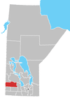
 Decker Location of Decker in Manitoba | |
| Coordinates: 50°16′12″N 100°46′54″W / 50.27000°N 100.78167°WCoordinates: 50°16′12″N 100°46′54″W / 50.27000°N 100.78167°W | |
| Country |
|
| Province |
|
| Region | Westman Region |
| Census Division | No. 15 |
| Government | |
| • Governing Body | Rural Municipality of Hamiota Council |
| • MP | Robert Sopuck |
| • MLA | Larry Maguire |
| Time zone | UTC−6 (CST) |
| • Summer (DST) | UTC−5 (CDT) |
| Postal Code | R0M 0K0 |
| Area code(s) | 204 |
| NTS Map | 062K0& |
| GNBC Code | GAGGY |
Decker is an unincorporated community in southwestern Manitoba, Canada. It is located approximately 17 kilometers (10 miles) northwest of Hamiota, Manitoba[1] in the Rural Municipality of Hamiota.
The community formed around the Decker family homestead. They arrived there in 1881 and the Post Office opened for the area in 1884 as Arrowton, named for the nearby Arrow River. In 1912 the Post Office was moved to the Decker homestead on 18-15-24W. Nowadays, there is almost nothing left, save for a church, 3 houses and a few old unused shops.
References
- Geographic Names of Manitoba - Decker (pg. 62) published by the Millenium Bureau of Canada
Division No. 15, Manitoba (Western Manitoba) | ||||
|---|---|---|---|---|
| Towns |
|  | ||
| Villages |
| |||
| Rural municipalities |
| |||
| First Nations | ||||
| Indian reserves | ||||
| Unincorporated communities |
| |||
This article is issued from
Wikipedia.
The text is licensed under Creative Commons - Attribution - Sharealike.
Additional terms may apply for the media files.