Darch, Western Australia
| Darch Perth, Western Australia | |||||||||||||||
|---|---|---|---|---|---|---|---|---|---|---|---|---|---|---|---|
 Darch | |||||||||||||||
| Coordinates | 31°48′43″S 115°50′46″E / 31.812°S 115.846°ECoordinates: 31°48′43″S 115°50′46″E / 31.812°S 115.846°E | ||||||||||||||
| Population | 6,118 (2011 census)[1] | ||||||||||||||
| • Density | 1,905.9/km2 (4,936/sq mi) | ||||||||||||||
| Postcode(s) | 6065 | ||||||||||||||
| Area | 3.21 km2 (1.2 sq mi) | ||||||||||||||
| Location | 20 km (12 mi) N of Perth CBD | ||||||||||||||
| LGA(s) | City of Wanneroo | ||||||||||||||
| State electorate(s) | Girrawheen | ||||||||||||||
| Federal Division(s) | Cowan | ||||||||||||||
| |||||||||||||||
Darch is a suburb of Perth, Western Australia, located within the City of Wanneroo approximately 20 kilometres (12 mi) north of Perth's central business district. Previously part of Landsdale, much of the suburb was rural in character until the late 1990s. It was named after an early settler family in the area, with the name being approved by the Geographic Names Committee on 5 March 1998. The area was subsequently opened to residential development, especially from 2001 onwards, as part of Cell 6 of the East Wanneroo Development Area.
Darch contains four schools — Ashdale Primary School, opened in 2005 with 243 pre-school and 596 primary students as of Semester 2, 2008; Kingsway Christian College, a non-denominational Christian school founded in 1983, initially known as Northern Districts Christian College; Landsdale Farm School, an education support school developed for students with disabilities; and Ashdale Secondary College, which opened in 2009 for the suburb's high school students, and is located on Westport Parade across from Ashdale Primary School and close to Kingsway Christian College.
The suburb contains several small residential parks as well as Landsdale Park, a bushland reserve with interpretative signage. Residents are served for shopping needs by the Darch Plaza shopping centre, and the larger Kingsway City Shopping Centre to the west.
The suburb is serviced by three Transperth bus routes, both operated by Transdev WA. The 352 route, which enters the suburb and serves the central section, links to Whitfords railway station; the 450, running along Kingsway, links to Warwick railway station, whilst the 372 route, which terminates on Landsdale Road in the suburb's southwestern corner, links to Mirrabooka bus station. Both termini offer services to central Perth.
References
- ↑ Australian Bureau of Statistics (31 October 2012). "State Suburbs: Darch". 2011 Census QuickStats. Retrieved 4 July 2012.

Suburbs and localities of the City of Wanneroo, Perth, Western Australia | ||
|---|---|---|
| North West | 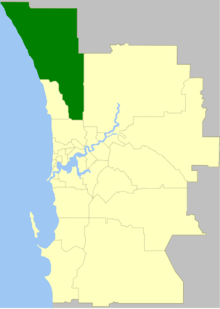 | |
| North East | ||
| South | ||
¹ Suburb shared with the City of Joondalup | ||