Damavand, Iran
| Damavand Damāwand | |
|---|---|
| City | |
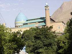 The 15th century Jame mosque of Damavand. | |
 Damavand | |
| Coordinates: 35°43′04″N 52°03′54″E / 35.71778°N 52.06500°ECoordinates: 35°43′04″N 52°03′54″E / 35.71778°N 52.06500°E | |
| Country |
|
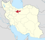
| Province | Tehran |
| County | Damavand |
| Bakhsh | Central |
| Population (2016 Census) | |
| • Total | 48,380 [1] |
| Time zone | UTC+3:30 (IRST) |
| • Summer (DST) | UTC+4:30 (IRDT) |
| Website | Official website |
Damawand (Persian: Damāwand, also Romanized as Damāvand and Demāvend; also known as Qasabehe Damāwand)[2] is a city and capital of Damavand County, Tehran Province, Iran. At the 2006 census, its population was 56,315, in 11,279 families.[3]
Damavand is an ancient and historic city. The name Damavand appears in Sassanid texts (as Dunbawand), and Parthian remains have been found there. The city fell to Arab Muslim invaders in 651 CE. It is close to Iran's tallest peak Mount Damavand, which Ferdowsi mentions abundantly in the Shahnameh. The city has relatively cool weather year-round.
Main sights
Damavand contains 37 historical tombs (Imamzadeh), 27 castle ruins, 23 traditional houses of architectural significance, 18 traditional bath houses, 6 caves, 5 historical bridges, 3 historical mosques, and 3 caravanserais.
The main landmarks are the Friday Mosque (15th century) and the Sheikh Shebli Mausoleum and Tower, dating to the Seljuq era.
Transportation
Damavand can be reached by road from Firuzkuh via Gilavand and from Haraz road, via Mosha.
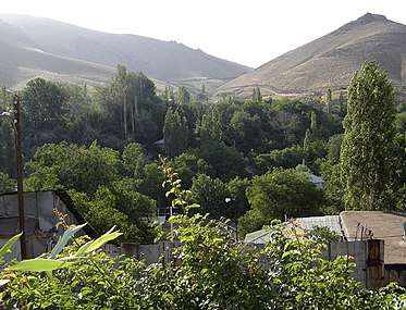 View of Damavand and the Alborz Mountains
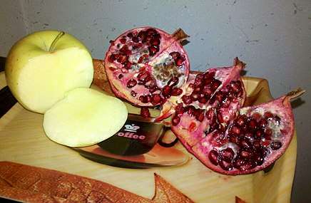 Damavand's pomegranate and apple
See also
References
- ↑ https://www.amar.org.ir/english
- ↑ Damavand, Iran can be found at GEOnet Names Server, at this link, by opening the Advanced Search box, entering "-3059147" in the "Unique Feature Id" form, and clicking on "Search Database".
- ↑ "Census of the Islamic Republic of Iran, 1385 (2006)". Islamic Republic of Iran. Archived from the original (Excel) on 2011-11-11.
External links
| Wikimedia Commons has media related to Damavand. |
| Capital | |||||||||||||||||||||||
|---|---|---|---|---|---|---|---|---|---|---|---|---|---|---|---|---|---|---|---|---|---|---|---|
| Districts |
| ||||||||||||||||||||||