Dalian Bay
| Dalian Bay | |||||||||||||||||||
| Chinese name | |||||||||||||||||||
|---|---|---|---|---|---|---|---|---|---|---|---|---|---|---|---|---|---|---|---|
| Simplified Chinese | 大连湾 | ||||||||||||||||||
| Traditional Chinese | 大連灣 | ||||||||||||||||||
| |||||||||||||||||||
| Japanese name | |||||||||||||||||||
| Kanji | 大連湾 | ||||||||||||||||||
| |||||||||||||||||||
| Russian name | |||||||||||||||||||
| Russian | Дальний Губа | ||||||||||||||||||
| Romanization | Dalniy Guba | ||||||||||||||||||
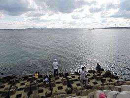
Dalian Bay (Chinese: 大连湾; pinyin: dàliánwān), known historically as Talianwan and Talien-hwan, is a bay on the southeast side of the Liaodong Peninsula (Chinese: 辽东半岛) of Northeast China, open to Korea Bay (Chinese: 黄海) in the east. Downtown Dalian lies along the southern shore of the bay. Its significance is that it is ice-free year-round, while Jinzhou Bay (Chinese: 金州湾) on the other, northwest side of the peninsula is part of the Bohai Sea (Chinese: 渤海), and is shallow and closed by ice for four months of the winter.
The bay was the rendezvous point for the British fleet for the 1860 assault on China during the Second Opium War. In 1879, about 20 small islands with their bays around Dalian were named Dalian Bay and barbettes for military use were built after that. By the end of the First Sino-Japanese War of 1894–1895, most of the barbettes were discarded and a fishery industry started quickly. Now. only six barbettes remain, and they are located on Monk Island. They were built between 1887 and 1893.
Dalian Bay has one of the biggest fishing ports in Asia and it plays an essential role in the Chinese fishery industry. It has been a famous seafood distribution center since the 1930s, with thousands of people involved in commercial fishing coming to Dalian Bay for various transactions.
See also
Coordinates: 38°57′24″N 121°41′58″E / 38.95667°N 121.69944°E