Crowes railway line
| Crowes railway | |||
|---|---|---|---|
| Overview | |||
| Type | Vic | ||
| Status | Abandoned | ||
| Stations | 23 | ||
| Operation | |||
| Opened | 1902/1911 | ||
| Closed | 1954/1962 | ||
| Technical | |||
| Line length | 44 mi (71 km) | ||
| Number of tracks | Single track | ||
| |||
The Crowes railway line was a 2 ft 6 in (762 mm) narrow gauge railway located in the Otway Ranges in south-western Victoria, Australia, running from the main line to Port Fairy at Colac to Beech Forest and later Crowes.
It was the third of four narrow gauge lines of the Victorian Railways, opening to Beech Forest in March 1902, and extended to Crowes in June 1911. Nearly 44 miles (71 km) long, this was the longest of the narrow gauge lines. It was also the last to close, finally succumbing in June 1962, although the line had been truncated in 1954.
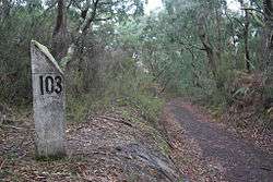
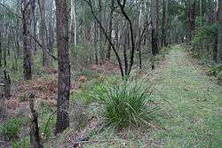
The route of the abandoned railway has been developed as the Old Beechy Rail Trail.
Operation
Both the Colac and Crowes lines entered Beech Forest yard from the same end, creating a junction. Trains had to be turned to run down the Crowes branch and a balloon loop was provided at the other end of the yard. A tennis court occupied the land within the loop. Crowes, the terminus of the line, was the most southerly railway station on the Australian mainland.
The primary traffic was sawn timber and firewood, with many sawmills located adjacent to the railway, or accessed by short tramways. Seasonally heavy potato traffic and a lime kiln added to revenue. Traffic grew to require up to 7 trains a day each way by the mid-1920s. The introduction of the G class Garratt locomotive allowed a new timetable with two trains each way between Colac and Beech Forest, and a third train each way to Gellibrand. The Crowes branch saw a single mixed train daily. The arrival of the Great Depression and competition from motor vehicles saw traffic decline to a point where only one train each way operated over the line three days a week. Increased wartime loadings saw traffic increase to two trains each way daily, however this improvement was only temporary. By the time the railway closed, the timetable listed only one train each way a week, and most of the traffic was pulpwood.
The line opened using the Staff and Ticket method of safeworking. However Train Section Orders were adopted between 1927 and 1939, after which Staff and Ticket working was resumed.
Line Guide
Crowes railway line | |||||||||||||||||||||||||||||||||||||||||||||||||||||||||||||||||||||||||||||||||||||||||||||||||||||||||||||||||||||||||||||||||||||||||||||||||||||||||||||||||||||||||||||||||||||||||||||||||||||||||||||||||||||||||||||||||||||||||||||||||||||||||||||||||||||||||||||||||||||||||||||||||||||||||||||||||||||||||||||||||||||||||||||||||||||||||||||||||||||||||||||||||||||||||||||||||||||||||||||||||||||||||||||||||||||||||||||||||||||||||||||||||||||||||||||||||||||||||||||||||||||||||||||||||||||
|---|---|---|---|---|---|---|---|---|---|---|---|---|---|---|---|---|---|---|---|---|---|---|---|---|---|---|---|---|---|---|---|---|---|---|---|---|---|---|---|---|---|---|---|---|---|---|---|---|---|---|---|---|---|---|---|---|---|---|---|---|---|---|---|---|---|---|---|---|---|---|---|---|---|---|---|---|---|---|---|---|---|---|---|---|---|---|---|---|---|---|---|---|---|---|---|---|---|---|---|---|---|---|---|---|---|---|---|---|---|---|---|---|---|---|---|---|---|---|---|---|---|---|---|---|---|---|---|---|---|---|---|---|---|---|---|---|---|---|---|---|---|---|---|---|---|---|---|---|---|---|---|---|---|---|---|---|---|---|---|---|---|---|---|---|---|---|---|---|---|---|---|---|---|---|---|---|---|---|---|---|---|---|---|---|---|---|---|---|---|---|---|---|---|---|---|---|---|---|---|---|---|---|---|---|---|---|---|---|---|---|---|---|---|---|---|---|---|---|---|---|---|---|---|---|---|---|---|---|---|---|---|---|---|---|---|---|---|---|---|---|---|---|---|---|---|---|---|---|---|---|---|---|---|---|---|---|---|---|---|---|---|---|---|---|---|---|---|---|---|---|---|---|---|---|---|---|---|---|---|---|---|---|---|---|---|---|---|---|---|---|---|---|---|---|---|---|---|---|---|---|---|---|---|---|---|---|---|---|---|---|---|---|---|---|---|---|---|---|---|---|---|---|---|---|---|---|---|---|---|---|---|---|---|---|---|---|---|---|---|---|---|---|---|---|---|---|---|---|---|---|---|---|---|---|---|---|---|---|---|---|---|---|---|---|---|---|---|---|---|---|---|---|---|---|---|---|---|---|---|---|---|---|---|---|---|---|---|---|---|---|---|---|---|---|---|---|---|---|---|---|---|---|---|---|---|---|---|---|---|---|---|---|---|---|---|---|---|---|---|---|---|---|---|---|---|---|---|---|---|---|---|---|---|---|---|---|---|---|---|---|---|---|---|---|---|---|---|---|---|---|---|---|---|---|---|---|---|---|---|---|---|---|---|---|---|---|---|---|---|---|---|---|---|---|---|---|---|---|---|---|---|---|---|---|---|---|---|---|---|---|---|---|---|---|---|---|---|---|---|---|---|
| |||||||||||||||||||||||||||||||||||||||||||||||||||||||||||||||||||||||||||||||||||||||||||||||||||||||||||||||||||||||||||||||||||||||||||||||||||||||||||||||||||||||||||||||||||||||||||||||||||||||||||||||||||||||||||||||||||||||||||||||||||||||||||||||||||||||||||||||||||||||||||||||||||||||||||||||||||||||||||||||||||||||||||||||||||||||||||||||||||||||||||||||||||||||||||||||||||||||||||||||||||||||||||||||||||||||||||||||||||||||||||||||||||||||||||||||||||||||||||||||||||||||||||||||||||||
References
- Norman Houghton. "Colac-Beech Forest-Crowes Railway Conservation Management Plan" (PDF). Colac–Otway Shire. Archived from the original (PDF) on 2 August 2008. Retrieved 2008-11-02.
- "Old Beechy Rail Trail - Trail Description". www.railtrails.org.au. Retrieved 2015-05-18.
- Bill Russell. "Colac to Crowes Narrow Gauge Railway". Retrieved 2008-11-02.
Further reading
- Houghton, Norman 1992 The Beechy Light Railway Research Society of Australia, Melbourne ISBN 0-909340-29-3
| |||||||||||||||||||
| |||||||||||||||||||
| |||||||||||||||||||
| |||||||||||||||||||
| |||||||||||||||||||
Coordinates: 38°41′23″S 143°22′3″E / 38.68972°S 143.36750°E