Crib Point railway station
Crib Point | |||||||||||
|---|---|---|---|---|---|---|---|---|---|---|---|
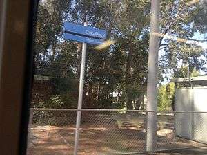 Station in October 2013 | |||||||||||
| Location |
Stony Point Road, Crib Point Australia | ||||||||||
| Coordinates | 38°21′58″S 145°12′15″E / 38.3660°S 145.2041°ECoordinates: 38°21′58″S 145°12′15″E / 38.3660°S 145.2041°E | ||||||||||
| Owned by | VicTrack | ||||||||||
| Operated by | Metro | ||||||||||
| Line(s) | Stony Point | ||||||||||
| Distance | 72.83 kilometres from Southern Cross | ||||||||||
| Platforms | 1 | ||||||||||
| Tracks | 1 | ||||||||||
| Connections | Bus | ||||||||||
| Construction | |||||||||||
| Structure type | Ground | ||||||||||
| Parking | 20 | ||||||||||
| Disabled access | Yes | ||||||||||
| Other information | |||||||||||
| Status | Unstaffed | ||||||||||
| Station code | CPT | ||||||||||
| Fare zone | Myki Zone 2 | ||||||||||
| Website | Public Transport Victoria | ||||||||||
| History | |||||||||||
| Opened | 17 December 1889 | ||||||||||
| Rebuilt | 1986 | ||||||||||
| Services | |||||||||||
| |||||||||||
Crib Point railway station is located on the Stony Point line, in Victoria, Australia. It serves the town of Crib Point and HMAS Cerberus, and opened on 17 December 1889.[1]
A former freight yard originally sat opposite of the station, while a branch line into HMAS Cerberus is located at the Up end of the station, past the level crossing.
Flashing lights were provided at the Naval Base Road level crossing in 1974.[2] Boom barriers were added to the level crossing in 2011.[3]
The former station building was replaced with the current passenger shelters in February 1986.[4]
Platforms & services
Crib Point has one platform. It is serviced by Metro Trains' Stony Point line services.[5]
Platform 1:
- Stony Point line: all stations services to Frankston & Stony Point
Transport links
Ventura Bus Lines operates one route via Crib Point station:
- 782: Frankston station – Flinders[6]
References
- ↑ Point Crib Point Vicsig
- ↑ "Way & Works". Newsrail. Australian Railway Historical Society. May 1974. p. 114.
- ↑ Naval Base Road Vicsig
- ↑ "Works". Newsrail. Australian Railway Historical Society. June 1986. p. 188.
- ↑ Stony Point Line timetable Public Transport Victoria
- ↑ Route 782 Frankston – Flinders timetable Public Transport Victoria
External links
| Wikimedia Commons has media related to Crib Point railway station, Melbourne. |
- Melway map at street-directory.com.au
This article is issued from
Wikipedia.
The text is licensed under Creative Commons - Attribution - Sharealike.
Additional terms may apply for the media files.