Creußen
| Creußen | ||
|---|---|---|
| ||
 Creußen Location of Creußen within Bayreuth district 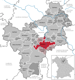 | ||
| Coordinates: 49°50′38.35″N 11°37′21.63″E / 49.8439861°N 11.6226750°ECoordinates: 49°50′38.35″N 11°37′21.63″E / 49.8439861°N 11.6226750°E | ||
| Country | Germany | |
| State | Bavaria | |
| Admin. region | Oberfranken | |
| District | Bayreuth | |
| Municipal assoc. | Creußen | |
| Government | ||
| • Mayor | Martin Dannhäuser (CSU) | |
| Area | ||
| • Total | 66.48 km2 (25.67 sq mi) | |
| Elevation | 426-640 m (−1,674 ft) | |
| Population (2017-12-31)[1] | ||
| • Total | 4,926 | |
| • Density | 74/km2 (190/sq mi) | |
| Time zone | CET/CEST (UTC+1/+2) | |
| Postal codes | 95473 | |
| Dialling codes | 09270 | |
| Vehicle registration | BT | |
| Website | www.stadt-creussen.de | |

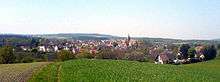
Creußen is a town in the district of Bayreuth in Bavaria, Germany. It is situated on the Red Main river, 13 km southeast of Bayreuth.
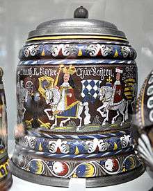
Creußen painted stoneware beer stein of 1696 from the Victoria and Albert Museum
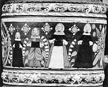
Creußen painted stoneware beer stein of 1675 from the Metropolitan Museum of Art
Creußen is famous for its stoneware beer steins.
Creußen is the starting point of the Red Main branch of the Main-Radweg bicycle path which stretches about 600 km along the Main until the mouth into the Rhine.
Sons and daughters
- Christoph Wirth (1870–1950), German physicist and inventor
| Wikimedia Commons has media related to Creußen. |
| Wikimedia Commons has media related to Creußen Stoneware. |
References
- ↑ "Fortschreibung des Bevölkerungsstandes". Bayerisches Landesamt für Statistik und Datenverarbeitung (in German). September 2018.
| Authority control |
|---|
This article is issued from
Wikipedia.
The text is licensed under Creative Commons - Attribution - Sharealike.
Additional terms may apply for the media files.