Coxford, Cornwall

Coxford is a hamlet in the parish of St Gennys (where the 2011 census population was included ) in north Cornwall, England.[1][2]
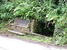
A well and seat at Coxford
References
Cornwall Portal | |
| Unitary authorities | |
| Major settlements |
|
| Rivers | |
| Topics | |
This article is issued from
Wikipedia.
The text is licensed under Creative Commons - Attribution - Sharealike.
Additional terms may apply for the media files.