Cowlands

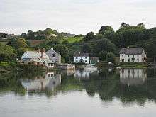
Cowlands is a hamlet at the head of Coombe Creek southeast of Playing Place in Cornwall, England.[1][2] According to the Post Office the population at the 2011 Census was included in the civil parish of Truro.
Cowlands
References
Cornwall Portal | |
| Unitary authorities | |
| Major settlements |
|
| Rivers | |
| Topics | |
This article is issued from
Wikipedia.
The text is licensed under Creative Commons - Attribution - Sharealike.
Additional terms may apply for the media files.