County of Balurga

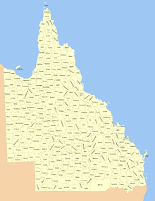
The 319 counties of Queensland in 1901.

The County of Balurga is a county (a cadastral division) in Queensland, Australia. It is located in Far North Queensland, east of Kowanyama on the Cape York Peninsula.[1] On 7 March 1901, the Governor issued a proclamation legally dividing Queensland into counties under the Land Act 1897.[2] Its schedule described Balurga thus:

Bounded on the north by the counties of Kalkah and Lukin; on the west by the county of Koolatah; on the south by the south boundaries of Koolatah, Koolatah No. 4, Koolatah No. 7, Cootah No. 2 and Cootah No. 3 Blocks; and on the east by the east boundaries of Cootah No. 3, Cootah No. 1, Goathland No.3 and Goathland No. 9.

Parishes

ParishLGACoordinates
BalurgaCook14°55′S 142°15′E / 14.917°S 142.250°E / -14.917; 142.250 (Balurga Parish)
CloughtonCook15°04′S 142°24′E / 15.067°S 142.400°E / -15.067; 142.400 (Cloughton Parish)
ColemanCook14°55′S 142°28′E / 14.917°S 142.467°E / -14.917; 142.467 (Coleman Parish)
GoathlandCook15°06′S 142°40′E / 15.100°S 142.667°E / -15.100; 142.667 (Goathland Parish)
GreenhowCook15°07′S 142°54′E / 15.117°S 142.900°E / -15.117; 142.900 (Greenhow Parish)
HarknessCook15°14′S 142°38′E / 15.233°S 142.633°E / -15.233; 142.633 (Harkness Parish)
HelmsleyCook15°24′S 142°51′E / 15.400°S 142.850°E / -15.400; 142.850 (Helmsley Parish)
InglebyCook14°59′S 142°55′E / 14.983°S 142.917°E / -14.983; 142.917 (Ingleby Parish)
LevishamCook15°12′S 142°22′E / 15.200°S 142.367°E / -15.200; 142.367 (Levisham Parish)
MungardaCook14°56′S 142°41′E / 14.933°S 142.683°E / -14.933; 142.683 (Mungarda Parish)
SeftonCook15°21′S 142°20′E / 15.350°S 142.333°E / -15.350; 142.333 (Sefton Parish)
SnaintonCook15°16′S 142°53′E / 15.267°S 142.883°E / -15.267; 142.883 (Snainton Parish)
WykehamCook15°23′S 142°35′E / 15.383°S 142.583°E / -15.383; 142.583 (Wykeham Parish)

References

  1. "Balurga (entry 1443)". Queensland Place Names. Queensland Government. Retrieved 1 September 2015.
  2. "A Proclamation". Queensland Government Gazette. 75. 8 March 1901. pp. 967–980.

Coordinates: 15°04′S 142°32′E / 15.067°S 142.533°E / -15.067; 142.533


This article is issued from Wikipedia. The text is licensed under Creative Commons - Attribution - Sharealike. Additional terms may apply for the media files.