Corinth, Maine
| Corinth, Maine | |
|---|---|
| Town | |
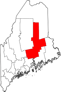
 Corinth, Maine Location within the state of Maine | |
| Coordinates: 44°59′10″N 68°59′57″W / 44.98611°N 68.99917°WCoordinates: 44°59′10″N 68°59′57″W / 44.98611°N 68.99917°W | |
| Country | United States |
| State | Maine |
| County | Penobscot |
| Area[1] | |
| • Total | 40.27 sq mi (104.30 km2) |
| • Land | 40.27 sq mi (104.30 km2) |
| • Water | 0 sq mi (0 km2) |
| Elevation | 220 ft (67 m) |
| Population (2010)[2] | |
| • Total | 2,878 |
| • Estimate (2012[3]) | 2,862 |
| • Density | 71.5/sq mi (27.6/km2) |
| Time zone | UTC-5 (Eastern (EST)) |
| • Summer (DST) | UTC-4 (EDT) |
| ZIP code | 04427 |
| Area code(s) | 207 |
| FIPS code | 23-14380 |
| GNIS feature ID | 0582420 |
| Website |
www |
Corinth is a town in Penobscot County, Maine, United States. The population was 2,878 at the 2010 census.[4]
History
Abner Sr Tibbetts was the founder of Corinth. In 1792 he built his home on Lot 10 First Range. Tibbetts enlisted as a private in Captain Reuben Dyers' company at the age of 17 on May 26, 1777, from Gouldsboro, Maine. Tibbetts' grave, with an official grave marker of a Revolutionary War soldier, is found in the East Exeter cemetery.
The town was settled in the late 1790s by the extended Daniel Skinner family and originally called "Ohio". There is still an "Ohio Street" in nearby Bangor, being a portion of the original road or trail connecting that town with what is now Corinth. When the town was incorporated in 1811, it changed its name to Corinth, a reference to the classical Greek city. A number of Penobscot County towns incorporated in the same period such as Etna, Carmel, and Levant (and Troy, in neighboring Waldo County) were given similarly exotic names, referencing the ancient Mediterranean world, probably in order to help attract settlers. Some of these names also have Biblical references.
By the mid-19th century the town had three villages: East Corinth, West Corinth, and South Corinth. East Corinth emerged as the largest, and had five shops making carriages and sleighs (a local specialty) by the 1850s.
The Skinner Settlement in West Corinth is listed on the National Register of Historic Places. This early 19th century village-scape includes a general store, schoolhouse, and Methodist church. The Robeyville Covered Bridge near East Corinth is also listed on the National Register, and is one of very few such bridges to survive in Maine.
Geography
According to the United States Census Bureau, the town has a total area of 40.27 square miles (104.30 km2), of which 38% is covered in forest.[1]
Demographics
| Historical population | |||
|---|---|---|---|
| Census | Pop. | %± | |
| 1820 | 296 | — | |
| 1830 | 712 | 140.5% | |
| 1840 | 1,318 | 85.1% | |
| 1850 | 1,600 | 21.4% | |
| 1860 | 1,790 | 11.9% | |
| 1870 | 1,462 | −18.3% | |
| 1880 | 1,333 | −8.8% | |
| 1890 | 1,154 | −13.4% | |
| 1900 | 1,042 | −9.7% | |
| 1910 | 1,034 | −0.8% | |
| 1920 | 891 | −13.8% | |
| 1930 | 931 | 4.5% | |
| 1940 | 954 | 2.5% | |
| 1950 | 1,167 | 22.3% | |
| 1960 | 1,138 | −2.5% | |
| 1970 | 1,212 | 6.5% | |
| 1980 | 1,711 | 41.2% | |
| 1990 | 2,177 | 27.2% | |
| 2000 | 2,511 | 15.3% | |
| 2010 | 2,878 | 14.6% | |
| Est. 2014 | 2,850 | [5] | −1.0% |
| U.S. Decennial Census[6] | |||
2010 census
As of the census[2] of 2010, there were 2,878 people, 1,125 households, and 798 families residing in the town. The population density was 71.5 inhabitants per square mile (27.6/km2). There were 1,233 housing units at an average density of 30.6 per square mile (11.8/km2). The racial makeup of the town was 97.4% White, 0.3% African American, 0.5% Native American, 0.3% Asian, 0.1% from other races, and 1.4% from two or more races. Hispanic or Latino of any race were 0.7% of the population.
There were 1,125 households of which 33.5% had children under the age of 18 living with them, 55.9% were married couples living together, 9.9% had a female householder with no husband present, 5.2% had a male householder with no wife present, and 29.1% were non-families. 21.7% of all households were made up of individuals and 7.9% had someone living alone who was 65 years of age or older. The average household size was 2.56 and the average family size was 2.94.
The median age in the town was 40.4 years. 24.7% of residents were under the age of 18; 7.2% were between the ages of 18 and 24; 25.2% were from 25 to 44; 29.7% were from 45 to 64; and 13.1% were 65 years of age or older. The gender makeup of the town was 48.9% male and 51.1% female.
2000 census
As of the census[7] of 2000, there were 2,511 people, 959 households, and 715 families residing in the town. The population density was 62.5 people per square mile (24.1/km²). There were 1,040 housing units at an average density of 25.9 per square mile (10.0/km²). The racial makeup of the town was 98.17% White, 0.08% African American, 0.64% Native American, 0.08% Asian, 0.48% from other races, and 0.56% from two or more races. Hispanic or Latino of any race were 0.76% of the population.
There were 959 households out of which 33.9% had children under the age of 18 living with them, 62.0% were married couples living together, 9.5% had a female householder with no husband present, and 25.4% were non-families. 18.7% of all households were made up of individuals and 7.2% had someone living alone who was 65 years of age or older. The average household size was 2.60 and the average family size was 2.91. In the town, the population was spread out with 25.6% under the age of 18, 7.9% from 18 to 24, 30.4% from 25 to 44, 24.9% from 45 to 64, and 11.2% who were 65 years of age or older. The median age was 36 years. For every 100 females, there were 95.7 males. For every 100 females age 18 and over, there were 93.2 males.
The median income for a household in the town was $37,318, and the median income for a family was $41,016. Males had a median income of $31,715 versus $25,071 for females. The per capita income for the town was $16,460. About 3.7% of families and 8.0% of the population were below the poverty line, including 5.2% of those under age 18 and 8.5% of those age 65 or over.
Government
Local government
The Town of Corinth has a Board of Selectmen form of Government.[8]
Political makeup
Corinth is a well known right-leaning town and has the second highest percent of Republican voters of all municipalities in Maine with a population over 2,000.[9]
Fire Department
Established in 1950 after the forest fires of 1947. Currently operates 2 Engines , 1 Ladder Truck, 2 Ambulances and 1 Brush Fire Unit. Has 24/7 Staffing with 2 Paramedics and a full time Fire Chief
Current Fire Chief is Scott Bragdon (1997)
Education
Corinth is part of Regional School Unit No. 64.[10]
Notable people from Penobscot, County, Maine
- Solomon Comstock, US congressman from Minnesota (1889–1891)[11]
- George W. Emery, 11th governor of the Utah Territory (1875–1880)[12][13]
- Arthur R. Gould (1857–1946), US senator (November 30, 1926, to March 3, 1931); president of the Aroostook Valley Railroad (1902–1946)[14]
- Frank Mason Robinson (1845–1923), Early marketer of the drink that became known as Coca-Cola[15]
- Henrietta Gould Rowe (1834/35–1910), litterateur, author
References
- 1 2 "US Gazetteer files 2010". United States Census Bureau. Retrieved 2012-12-16.
- 1 2 "American FactFinder". United States Census Bureau. Retrieved 2012-12-16.
- ↑ "Population Estimates". United States Census Bureau. Archived from the original on 2013-06-17. Retrieved 2013-07-06.
- ↑ "Geographic Identifiers: 2010 Demographic Profile Data (G001): Corinth town, Penobscot County, Maine". U.S. Census Bureau, American Factfinder. Retrieved November 16, 2012.
- ↑ "Annual Estimates of the Resident Population for Incorporated Places: April 1, 2010 to July 1, 2014". Retrieved June 4, 2015.
- ↑ "Census of Population and Housing". Census.gov. Archived from the original on May 12, 2015. Retrieved June 4, 2015.
- ↑ "American FactFinder". United States Census Bureau. Archived from the original on 2013-09-11. Retrieved 2008-01-31.
- ↑ http://maineanencyclopedia.com/corinth/
- ↑ http://www.pressherald.com/interactive/maine_registered_voters_democrat_republican_independent_green/
- ↑ Regional School Unit 64
- ↑ "COMSTOCK, Solomon Gilman - Biographical Information". bioguide.congress.gov. Retrieved 2018-06-14.
- ↑ Manti-La Sal National Forest (N.F.), Pines Tract Project: Environmental Impact Statement. 1999.
- ↑ "Territorial Governors of Utah - Utah Department of Heritage and Arts". Utah Department of Heritage and Arts. 2016-04-26. Retrieved 2018-06-14.
- ↑ "Gould, Arthur Robinson". Maine: An Encyclopedia. 2011-12-06. Retrieved 2018-06-14.
- ↑ Donovan, Tristan. Fizz: How Soda Shook up the World. Chicago, IL: Chicago Review, 2013. Print.